A Short History of Colonia del Sacramento (2026)

The cobblestones here are uneven, worn to a soft grey by three centuries of footfall. Walking into the Barrio Histórico of Colonia del Sacramento — the old walled quarter that juts out into the Río de la Plata — you get the feeling that the ground itself is trying to tell you something. It is. Every cracked stone, every roofless ruin open to the sky, every cannon set decoratively at a corner has a story that stretches back to 1680, to empire, to a territorial argument that took a century to resolve.
Understanding colonia del sacramento history transforms a pleasant afternoon in a photogenic town into something richer. The ruins make sense. The irregular streets make sense. Even the lighthouse perched incongruously on top of a crumbled convent makes sense — once you know what happened here.
Colonia del Sacramento history at a glance
Colonia del Sacramento was founded in January 1680 by Portuguese Governor Manuel Lobo, who arrived from Rio de Janeiro with five ships, some 400 soldiers and settlers, and orders from King Peter II to establish a foothold on the northern bank of the Río de la Plata, directly across from Spanish Buenos Aires. Over the following 148 years, the city changed hands eleven times between Portugal, Spain, and briefly the emerging Brazilian and Uruguayan states. UNESCO inscribed the Barrio Histórico as a World Heritage Site in 1995, recognizing the extraordinary survival of its colonial urban fabric — Portuguese street layout, Spanish-era buildings, and the scars of repeated destruction all compressed into 16 hectares on a small peninsula.
Who this guide is for
This article is for the traveler who wants to walk through the Barrio Histórico with some sense of what they are actually looking at — not just a pretty old town, but a living archive of one of the most contested pieces of real estate in colonial South America. You do not need to be a historian. You just need to be curious about the stones under your feet.
For the practicalities of getting there, see our guide to the Montevideo to Colonia route and, if you are crossing from Argentina, the comprehensive Colonia day trip from Buenos Aires guide.
Quick facts
| Detail | Information |
|---|---|
| Founded | 28 January 1680 |
| By whom | Manuel Lobo, Governor of Rio de Janeiro, on orders from King Peter II of Portugal |
| Changed hands | Eleven times (1680–1828) between Portugal, Spain, Brazil, and finally Uruguay |
| UNESCO designation | 1995, 19th Session of the World Heritage Committee (Cultural Criterion iv) |
| What survives today | 16-hectare walled quarter with Portuguese street plan, colonial-era ruins, bastion walls, lighthouse, and 17th–19th century civic and religious buildings |
| Best single site for history | Plaza Mayor and the ruins of the Convento de San Francisco, with the 1857 lighthouse above |
The Portuguese foundation: 1680
To understand why Colonia del Sacramento exists at all, you need to understand what it threatened. Across the Río de la Plata — close enough that on a clear day you can see the haze of Buenos Aires — sat one of Spain’s most important ports in the Americas. The Portuguese crown, newly restored after decades of Spanish subjugation, wanted leverage. Control over the north bank of the river mouth meant control over trade entering and leaving the interior of the continent.
Manuel Lobo reached the small peninsula on 20 January 1680, and within eight days his men had begun laying out the settlement they called Nova Colônia do Santíssimo Sacramento. The site was well chosen: surrounded by water on three sides, with a narrow land approach to the east that could be easily fortified. Lobo brought craftsmen and stonecutters as well as soldiers — this was not a temporary camp but a serious act of territorial assertion.

The Spanish in Buenos Aires were not going to accept this quietly. José de Garro, the Spanish governor, sent spies across the river within weeks. When his ultimatum to leave was ignored, he dispatched a force of roughly 3,400 men under the command of Antonio de Vera Mujica. On the night of 6–7 August 1680 — just seven months after the foundation stone was laid — the settlement was captured. Lobo was taken prisoner to Buenos Aires, where he died in January 1683.
The town’s survival came from diplomacy, not arms. A treaty signed in 1681 between Spain and Portugal returned Colonia to the Portuguese. The settlement’s first rebuilding effort was led by Field Marshal Duarte Teixeira Chaves, who arrived in 1683 and began reconstructing what Garro’s forces had taken apart. The colonia’s economy during this period was candid about its own nature: smuggling and cattle-hunting from the surrounding grasslands were the primary activities. The Portuguese were, in essence, operating a duty-free port next door to Spain’s most important southern gateway.
The Spanish-Portuguese conflict: eleven changes of hands
What followed is one of the more remarkable territorial ping-pong matches in colonial history. The city changed sovereign control eleven times over 148 years. Each transfer came with its own drama — sieges, treaties, rebuilding campaigns, and in one case a near-total destruction.
The second Spanish seizure came as a consequence of the War of the Spanish Succession (1702–1714). Governor Valdes Inclan of Buenos Aires ordered an attack in October 1704. Spanish forces under Baltazar García Ros besieged the colony until March 1705, when the Portuguese civilians were evacuated by sea. The Spanish then razed much of what stood, sparing only the churches and a bridge. The Treaty of Utrecht in 1713 handed the city back to Portugal again, and Governor Manuel Gomes Barbosa arrived in 1718 with over a thousand new colonists to begin yet another reconstruction.

The most productive period in the town’s colonial history followed. Governor António Pedro de Vasconcellos took office in March 1722 and transformed the settlement into what contemporaries described as the richest and best-defended city in the Río de la Plata region. He oversaw the construction of the coastal bastions — São Pedro de Alcântara, São Miguel, Santo António, São João, Carmo, and Santa Rita — whose footprints you can still trace today. A Spanish attack during the 1735–1737 war failed to dislodge the Portuguese, a sign of how seriously Vasconcellos had upgraded the defenses.
The third Spanish seizure came in 1762 during the Seven Years’ War, when Pedro Antonio de Cevallos forced the Portuguese governor’s surrender. The Treaty of Paris in 1763 returned the city once more to Portugal. Then, in 1777, the Second Cevallos expedition — this time at the head of the largest armada ever sent from Spain to the Americas — reconquered the city definitively from the Portuguese perspective. The Treaty of San Ildefonso, signed that same year, transferred Colonia to Spain in exchange for Portuguese territorial gains further north, near the upper Paraná River. The Portuguese never returned as a colonial power.
The subsequent trajectory was rapid. By 1811, local revolutionary forces under José Gervasio Artigas had driven out the Spanish as part of the broader independence movement sweeping the region. Portuguese Brazil occupied the territory in 1817. The city became part of independent Uruguay in 1828, following the Cisplatine War and the Treaty of Montevideo.
Life under colonial rule
Between the sieges, Colonia del Sacramento had a genuine life. The population was mixed from the beginning — Portuguese settlers, enslaved Africans, and a significant proportion of people engaged in the quasi-legal trade that was the settlement’s main purpose. The surrounding pampas provided cattle hides for export to Rio de Janeiro. In return, European goods flowed into the Spanish colonial interior without passing through the formal Spanish customs system.

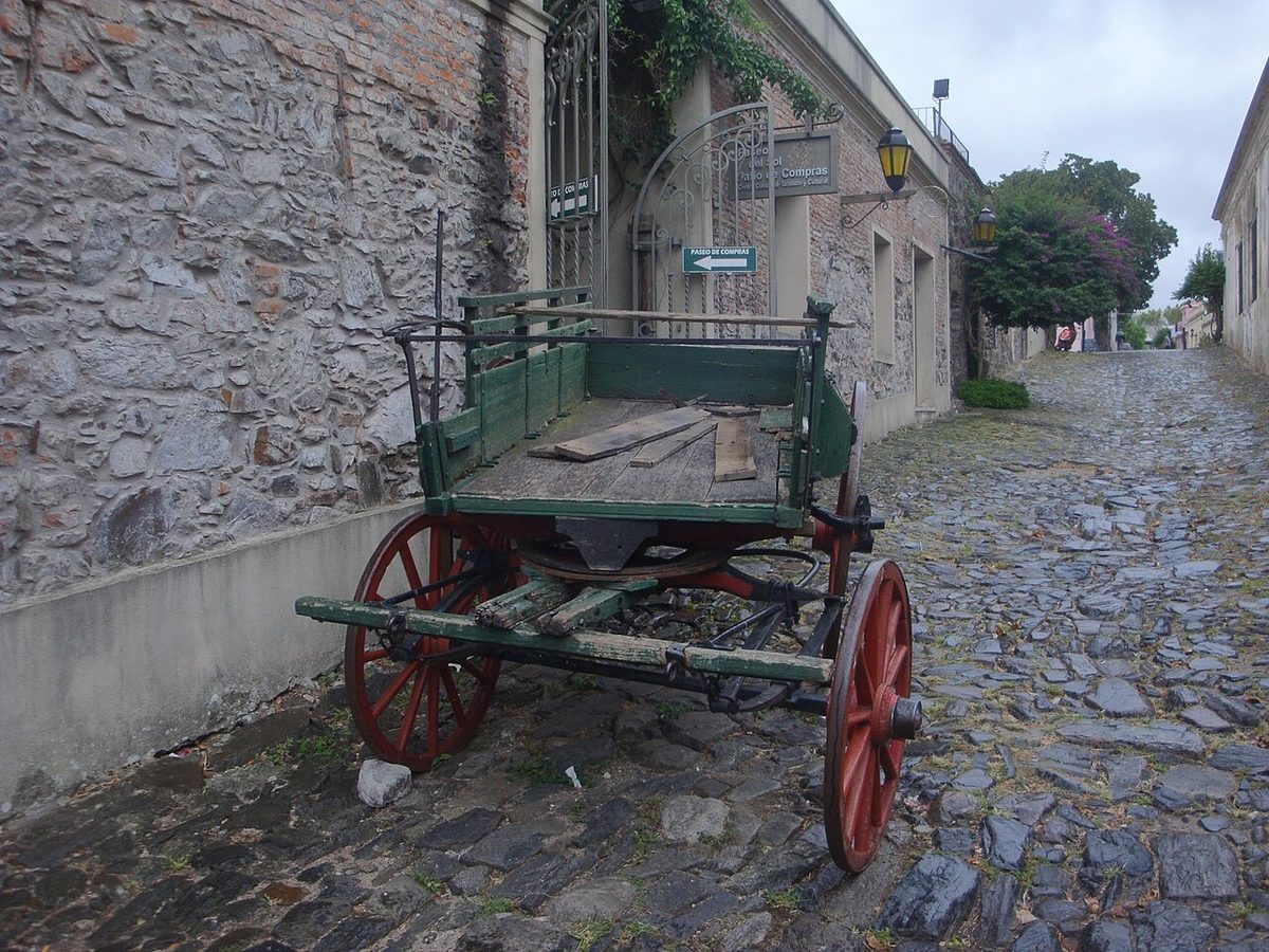
The architecture that survives reflects the particular character of the settlement. Unlike Spanish colonial towns, Colonia was never laid out on the rigid checkerboard grid mandated by Spain’s Laws of the Indies. The Portuguese adapted their plan to the topography of the peninsula — narrow lanes following the contours of the land, irregular lots, buildings that lean into the street. The street now called Calle de los Suspiros (Street of Sighs), one of the most photographed in Uruguay, is a direct product of this organic planning philosophy. The single-storey houses with long stone walls, wooden trellis screens, and tiled roofs that characterize the quarter reflect a construction tradition brought from Portugal and adapted to local conditions.
The city experienced considerable destruction — the 1704–1705 siege effectively leveled much of the original built fabric — so most of what you see today dates from the Portuguese golden period of the 1720s–1760s or from later Spanish and post-independence rebuilding. This layering is part of what makes the quarter historically unusual: it is not a single colonial moment preserved in amber, but a compressed sequence of colonial eras.
The Barrio Histórico today: reading the Portuguese city
Walking into the Barrio Histórico from the Puerta de la Ciudadela — the reconstructed city gate — you are crossing what was, for most of the colonial period, the only land entrance to the fortified quarter. The Portón de Campo (city gate) with its wooden drawbridge dates in its current form to 1745. It is theatrical without being fake: the stonework is the real thing, and the drawbridge mechanism is a faithful reconstruction of the original. Beyond the gate, the land entrance narrows to a ditch and earth rampart that once provided the peninsula’s only landward defense.
The plaza at the center of the quarter — the Plaza Mayor — is the organizing space of the colonial city. Most of the principal buildings cluster within a short walk of it. The plaza itself is pleasant rather than grand, shaded by trees, with the usual mix of tourists and local residents sharing the benches in the late afternoon. It is what surrounds it that commands attention.
Some ruins in the Barrio Histórico are better preserved than others. The remains of colonial-era walls vary dramatically in condition depending on which century’s episode of destruction or neglect they survived. Honest signage at most sites explains what you are looking at, though a basic understanding of the timeline helps considerably.
For a deeper exploration of the Barrio Histórico street by street, see our dedicated Barrio Histórico guide. What follows is a history-focused tour of the principal sites.
Key historical sites to visit
Portón de Campo and the city gate
The gate complex is the most theatrical entry point into the history of Colonia del Sacramento. The current structure dates from 1745, built during the Portuguese period of greatest investment in the city’s fortifications under Governor Vasconcellos’s successors. The moat and drawbridge arrangement reflects the standard European military engineering of the period — the same design principles you would find in fortifications across Portuguese Brazil and indeed across the Atlantic in Lisbon’s coastal defenses.

Stand at the gate and look back toward the land side: the low earthen ramparts that once enclosed the entire quarter are still visible in outline, even where the masonry has been removed or collapsed. Most of the fortification wall was demolished in 1777 — the Spanish, having finally secured the city, apparently saw no reason to maintain Portuguese defensive infrastructure — and further sections came down in 1859. What remains is fragmentary but legible.
Plaza Mayor and the ruins of the Convento de San Francisco
Off the southwest corner of the Plaza Mayor sit the ruins of the 17th-century Convento de San Francisco, one of the most visually striking sites in the Barrio Histórico. The convent was founded during the first decades of Portuguese settlement and suffered through the successive sieges. What you see today — roofless stone walls, a surviving apse, the characteristic mix of solid masonry and open sky — represents layers of destruction and partial reconstruction from the colonial period.
Rising directly above the ruins stands the 1857 lighthouse, built during the Uruguayan national period and perched on the old convent tower base with a certain cheerful disregard for architectural harmony. It is, nevertheless, worth the climb: from the top, the full layout of the peninsula is visible, and on clear days the Argentine coast appears as a dark line on the horizon.
Bastion del Carmen and the coastal fortifications
The shoreline of the Barrio Histórico preserves the footprints of the bastion system that Vasconcellos built in the 1720s and 1730s. The Bastion del Carmen is the best surviving example — a projecting angular platform that allowed defenders to fire along the face of the wall rather than directly outward, the defining innovation of early modern European military architecture. Standing on the bastion and looking back at the compact quarter, you get a sense of just how small the fortified area was: sixteen hectares, barely a medium-sized city block by modern standards, yet it consumed decades of diplomatic and military effort from two empires.
The Municipal Museum
The Municipal Museum, housed in a building rebuilt by the Spanish in 1835 as the Casa del Almirante Brown, holds the most comprehensive collection of artifacts from the various colonial periods. The exhibits include Portuguese-era furnishings, colonial-period maps and documents, weapons from the various sieges, and material from the later Spanish and independence-era phases. It is a useful anchor for understanding the sequence of changes of hands before walking the streets. Admission is modest and the staff are generally willing to explain the key exhibits in Spanish.

The Portuguese Museum and Casa de Nacarello
Constructed in the 18th century, the Portuguese Museum displays the furnishings, jewelry, uniforms, and naval maps that speak to the Portuguese colonial period specifically. The nearby Casa de Nacarello is an 18th-century Portuguese house preserved as a domestic interior — one of the better ways to understand how the wealthier inhabitants of the colony actually lived between the sieges. Both buildings are small and often overlooked by visitors hurrying toward the lighthouse, which means they are usually uncrowded.
UNESCO designation 1995: what it means for the town
The Barrio Histórico was inscribed as a UNESCO World Heritage Site in 1995 under Cultural Criterion iv, which recognizes sites that are outstanding examples of a type of building or architectural ensemble illustrating a significant stage in human history. The inscription specifically cited the Historic Quarter as the only example in the region of an urban plan that did not follow the Spanish colonial grid — the “irregular, terrain-fitting street plan built by the Portuguese,” as the UNESCO documentation puts it, contrasting with the “wider, orthogonal calles in the newer Spanish area” outside the walled quarter.
For a traveler, the practical effect of UNESCO status is a double-edged one. Colonia is extremely well preserved, carefully signposted, and protected by both Uruguayan national law (Law 14.040 of 1971, which lists all the buildings and public spaces as National Historic Monuments) and the international oversight that comes with UNESCO designation. The town is also genuinely popular with tourists — primarily day-trippers from Buenos Aires — which means that parts of the Barrio Histórico have shifted toward souvenir shops and restaurants.
The tension between heritage preservation and tourist-driven commercial change is something the UNESCO State of Conservation reports have flagged, noting the decrease in the local residential population and the increase in secondary residences and visitor-oriented businesses. The Historic Quarter is not in danger of losing its designation, but it is worth visiting with awareness that the quarter is simultaneously a living neighborhood and an internationally managed heritage site. See Uruguay’s UNESCO World Heritage Sites overview for the broader national context.
Reading the ruins: a practical guide for travelers
Walking the Barrio Histórico without some interpretive framework can feel like looking at a geological map without knowing what the colors mean. A few keys help unlock what you are seeing.
First, the street pattern itself is the oldest surviving artifact. The irregular lanes — nothing like the straight colonial grids of Montevideo or Buenos Aires — preserve the Portuguese planning decisions of the 1680s–1720s. Where the street is wide and orthogonal, you have moved outside the original fortified quarter into the later Spanish expansion.
Second, the material of the walls tells you something about date and phase. The oldest surviving fabric uses a characteristic combination of stone rubble and mud mortar, sometimes with a render of lime plaster. Later phases of rebuilding — particularly Spanish-era work after 1777 and post-independence 19th-century additions — used different stone-cutting techniques and brick proportions that are visible to a careful eye.
Third, the roofless ruins are not accidents of neglect. They are the direct physical result of the 1704–1705 siege, which leveled most of the original settlement, and the subsequent decision by various authorities not to fully rebuild certain structures. The Convento de San Francisco was never reconstructed as a functioning religious building after the 17th century; what you see is the archaeological reality of centuries of partial rebuilding, partial demolition, and weathering.
For where to stay while you explore all of this, the Where to stay in Colonia del Sacramento guide covers options in and around the historic quarter. For where to eat, see Colonia del Sacramento restaurants.
Colonia del Sacramento history: your questions answered
Why did the Portuguese choose this specific location?
The peninsula site was chosen for strategic and commercial reasons simultaneously. Strategically, it was defensible: surrounded by water on three sides, with a narrow land neck to the east. Commercially, it was positioned directly opposite Buenos Aires — the main entry point for Spanish colonial trade. A Portuguese settlement there could intercept and redirect trade flows, functioning effectively as a rival port that avoided Spanish customs duties. King Peter II’s desire to fix the southern border of Portuguese Brazil was the political motivation; the economic logic wrote itself.
How many times did Colonia del Sacramento change hands?
Eleven times between 1680 and 1828, passing between Portugal, Spain, Brazil, and finally Uruguay. The sequence is: Portugal (1680), Spain (1680–1681), Portugal (1681–1705), Spain (1705–1713/14), Portugal (1714–1762), Spain (1762–1763), Portugal (1763–1777), Spain (1777–1811), Liga Federal/revolutionary forces (1811–1817), Portugal/Brazil (1817–1828), Uruguay (1828–present). Each transfer came via treaty or military conquest, often both.
What does the UNESCO designation actually protect?
The inscription covers 16 hectares of the historic quarter itself plus a 57-hectare buffer zone. Under Uruguayan national law, all buildings and public spaces within the Barrio Histórico are classified as National Historic Monuments, meaning any modification requires government approval. UNESCO oversight adds an additional layer of international scrutiny, with regular State of Conservation reports submitted to the World Heritage Committee. The protections apply to the urban plan, the public spaces, and all the individual buildings.
What is Calle de los Suspiros?
Calle de los Suspiros — the Street of Sighs — is a short cobblestone lane in the Barrio Histórico that has become the most photographed street in Uruguay. It runs between low whitewashed houses with colonial-era proportions, with the Río de la Plata visible at one end. The name is evocative but its origin is uncertain; various folk explanations attribute it to colonial-era prisoners, separated lovers, or simply the sound of the wind. The street itself dates from the Portuguese period, and its preservation reflects the general integrity of the quarter’s urban fabric.
When did Colonia become part of Uruguay?
In 1828, following the end of the Cisplatine War (1825–1828) between Brazil and the United Provinces of the Río de la Plata. The Convention of Montevideo, signed that year, established Uruguay as an independent buffer state between the two regional powers. Colonia, which had been part of the Brazilian province of Cisplatina since 1817, was incorporated into the new Uruguayan state. The transition ended 148 years of Portuguese, Spanish, and Brazilian colonial administration.
Is the Barrio Histórico the only colonial quarter in Uruguay?
It is the most complete and the only UNESCO-listed one. Other Uruguayan cities have colonial-era buildings and historic centers — Montevideo’s Ciudad Vieja contains significant 19th-century architecture — but none preserves the same density of 17th and 18th-century fabric within a coherent urban plan. The combination of the Portuguese street layout, the colonial-era ruins, the bastion walls, and the sequence of civic and religious buildings is unique in the region. Uruguay has other significant heritage sites, but Colonia del Sacramento stands alone as a World Heritage property.
How long do I need to understand the history properly?
An afternoon is enough for the main sites if you move purposefully. Two days allows you to visit the Municipal Museum in depth, climb the lighthouse, walk the full perimeter of the bastion walls along the waterfront, and sit with the ruins long enough for them to start making sense. Day-trippers from Buenos Aires are the majority of visitors, so the quarter can feel crowded in the late morning and early afternoon; arriving early or staying overnight transforms the experience. See the full Colonia del Sacramento complete guide for detailed planning advice.
Final thoughts
Three hundred and forty-six years is a long time for a small peninsula to carry the weight of two empires arguing over it. What makes Colonia del Sacramento remarkable is not just that it survived — many colonial sites survive — but that it survived in such a compressed and legible form. The Portuguese street plan is still there. The bastion walls are still there, fragmentary but traceable. The Convento de San Francisco stands open to the sky in the same ruinous condition it has occupied since the 17th century, and the 1857 lighthouse sits on top of it with characteristic Uruguayan pragmatism.
Walking the Barrio Histórico with some knowledge of the colonia del sacramento history does not diminish the pleasure of the place. If anything, it deepens it. You stop seeing a charming colonial town and start seeing a record — imperfect, patched, occasionally rebuilt from scratch — of what happens when two empires decide the same piece of real estate is worth fighting over repeatedly. Uruguay ended up with the result, and travelers are the beneficiaries.
For broader context on Uruguay as a travel destination, the things to do in Uruguay guide and our best places to visit in Uruguay overview are good starting points. If you are combining this trip with Argentina, see the Argentina and Uruguay itinerary. For a full Uruguay circuit, the Uruguay itinerary guide covers the whole country.
Credits & sources
Sources & further reading
- UNESCO World Heritage Centre — Historic Quarter of the City of Colonia del Sacramento
- Wikipedia — Colonia del Sacramento (with primary source citations from Mayor, Federico; de Sanguinetti, Marta Canessa et al., Colonia del Sacramento, UNESCO, 1996)
- Assunção, Fernando O.; Cravotto, Antonio. Colonia del Sacramento, patrimonio mundial. Montevideo: UNESCO, 1996.
- Rela, Walter. Colonia del Sacramento, 1678–1778: Historia política, militar y diplomática. Editorial Académica Española, 2011.
Photo credits
All images via Wikimedia Commons: Colonia Del Sacramento Barrio Historico Aerial by Banfield (CC BY-SA 3.0); Colonia Del Sacramento Portao De Campo Gate by User:HalloweenHJB (CC BY-SA 3.0); Colonia Del Sacramento Calle De Los Suspiros by Banfield (CC BY-SA 3.0); Colonia Del Sacramento Convento San Francisco Ruins by Huguitoportal (CC BY-SA 3.0); Colonia Del Sacramento Lighthouse From Ruins by Heretiq (CC BY-SA 3.0); Colonia Del Sacramento Plaza Mayor Ruins by Mx. Granger (CC0).