Santa Teresa National Park: Fortress, Beaches & Camping (2026)
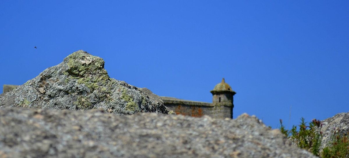
The first time I walked through the main gate of the Fortaleza de Santa Teresa, what struck me was the silence inside the walls. Step through that thick wooden door and the wind drops away: five bastions, a hectare of carved stone, a parade ground where Spanish and Portuguese garrisons once stared each other down. Climb to the ramparts and the view runs on forever.
That contrast, between the fort and the planted forest around it, is the whole appeal here.
Santa Teresa National Park Uruguay, also called Parque Nacional Santa Teresa, is a 3,000-hectare coastal park in the Rocha department of eastern Uruguay, run by the national army, combining a restored colonial fortress, twelve kilometres of Atlantic beaches, a vast forested public campground, botanical gardens and a wildlife refuge. Entry to the park itself is free. It sits on Route 9 just north of Punta del Diablo, near the Brazilian border.
I have come back to santa teresa national park uruguay more than once, in different seasons, and it rewards a slow visit. This is not a place you tick off in an hour. It is somewhere you camp, or at least give a full day to, wandering between the fort, the rose garden and a half-empty beach.
What this guide covers
Below I walk you through the Fortaleza de Santa Teresa and its strange, three-flag history; the enormous campground and how it actually works; the four main beaches and which one suits which mood; the gardens, the nursery and the wildlife you can expect to see; and the things worth doing nearby, from Cerro Verde to the Brazilian border at Chuy. I will also be honest about the drawbacks, because a forest campground that sleeps ten thousand people is a wonderful thing in October and a different thing entirely in January.
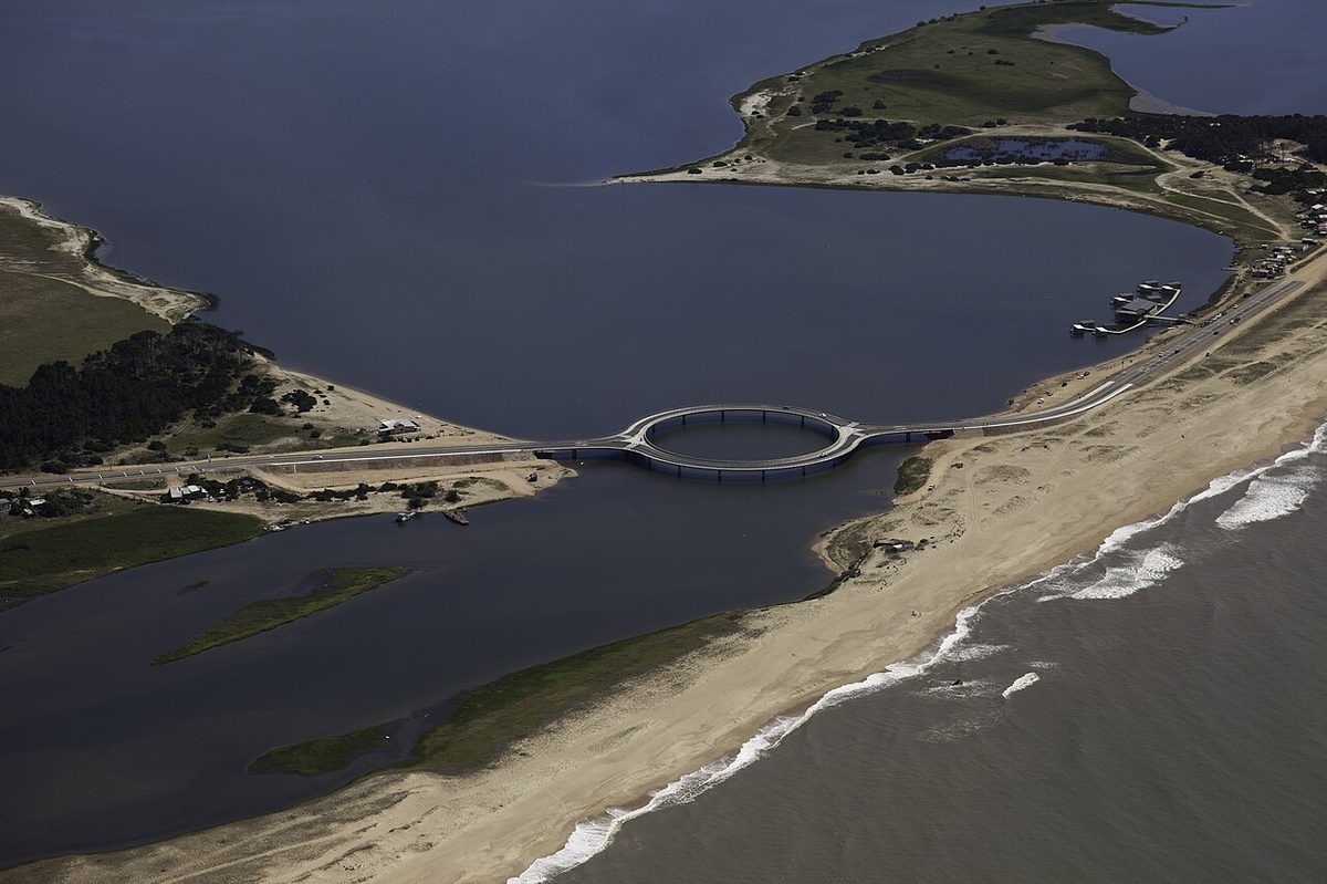
Santa Teresa sits inside the wider beach country of Rocha, Uruguay’s wildest coastal department, so I will point you toward its neighbours rather than re-explaining them here. That coast runs all the way from the circular Laguna Garzón bridge in the south-west to the Brazilian border a short drive north of the park.
| At a glance | Santa Teresa National Park |
|---|---|
| Where | Atlantic coast of Rocha, eastern Uruguay; Route 9 around km 302 |
| Run by | The National Army of Uruguay (Servicio de Parques del Ejercito, SEPAE) |
| Size | Around 3,000 hectares, about 1,400 of it planted forest, over 2 million trees |
| Park entry | Free; park gates generally open Tuesday to Sunday, roughly 8:00 to 18:00 |
| Fortress entry | Around 40 to 50 pesos (well under USD 2); reduced winter days and hours |
| Camping | Around 1,600 plots, capacity up to ~10,000 people; roughly USD 10 to 15 per night, hedged |
| Beaches | About 12 km of coast: Playa Grande, La Moza, Playa Achiras, Playa del Barco |
| Nearest town | Punta del Diablo, about 10 km south, the usual base and gateway |
| Border | Chuy and the Brazilian frontier about 35 km north |
| Best for | Campers, families, history lovers, surfers, birdwatchers |
| You really need | A car, or organised transport; the park is big and spread out |
The Fortaleza de Santa Teresa: a fort with three flags
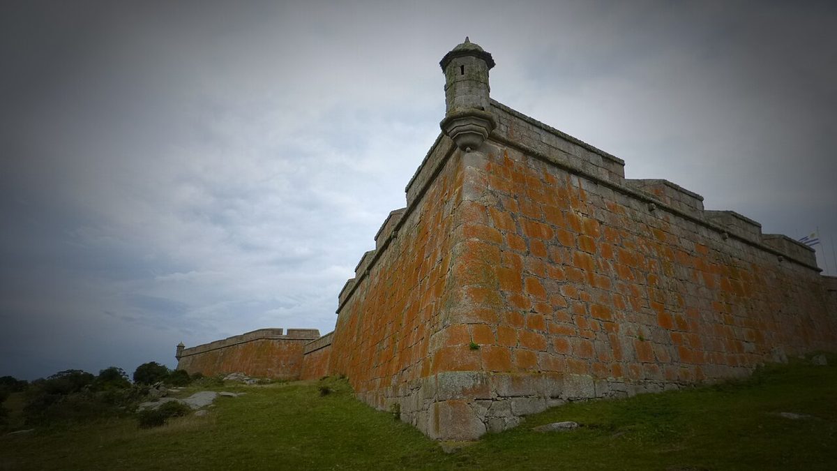
A fortaleza is simply a fortress, and this one has the kind of tangled origin story that explains a lot about this corner of South America. The Portuguese began it in October 1762, having given up on an earlier fort attempt down in Maldonado. They chose a rocky rise about 58 metres above sea level, at a narrow pass called La Angostura, the only dry route through the marshes to the sea. It was a smart, mean little spot to hold.
They did not hold it for long. In the wars between the two Iberian crowns, the Spanish general Pedro de Cevallos took the half-built fort, kept the foundations and the name, and ordered it rebuilt facing the other way, against Portuguese Brazil. The fortress you walk through today is essentially Spanish work, designed by the engineer Bartolome Howel and built, between roughly 1765 and 1775, by an ex-Jesuit named Lucas Marton with convict labour and Guarani workers. The Treaty of San Ildefonso in 1777 confirmed it as Spanish. When Uruguay became a republic in 1828, the fort became state property and, slowly, a ruin.
For most of the 19th century it was left to cattle and bats. The man who saved it was Horacio Arredondo, a historian and archaeologist who proposed restoring the fort in 1921 and, from 1928, actually did it, alongside the smaller Fuerte San Miguel up near the border. Arredondo is the figure to remember here, because he did not just rebuild the walls. He planted the forest too. That is worth holding in your head as you drive in under the pines: the whole green world around the fort is, in large part, one obsessive man’s project.
What you actually see inside
The fort is an irregular pentagon with five projecting bastions, a perimeter of about 652 metres, and walls of carved granite masonry that reach roughly 11.5 metres high in places. Inside, the colonial buildings have been restored with replacement roofs: the Comandancia (the commander’s quarters), what was once the chapel, two long barrack blocks where the troops slept, a powder magazine built of huge granite blocks, the cells, a kitchen with replica 18th-century implements, a blacksmith’s forge and an infirmary. Cannons sit in the embrasures along the walls. There are tunnels that served as emergency exits, and the persistent local legend of a hidden underground chamber, the Arca secreta del Padre Lucas, said to run toward the ocean.
There is a small museum inside, and it is a genuinely good one for its size: models of the other Uruguayan fortresses, a collection of period weapons, armour, uniforms and the gear of colonial garrison life. You can read the whole place in 45 minutes to an hour, longer if you like military history. Then climb to the ramparts for the views over the dunes and forest, which are the real reward.
One honest note: the fort is a separate ticket from the free park, and its opening days are stingier than you would expect. In summer it has tended to open Wednesday to Sunday in the afternoons, and in winter only Friday to Sunday and holidays, with shorter hours. The entrance fee is tiny, around 40 to 50 pesos, but turning up on a closed Monday or Tuesday is a classic mistake. Check current hours before you build your day around it.
The campground: a forest that sleeps thousands
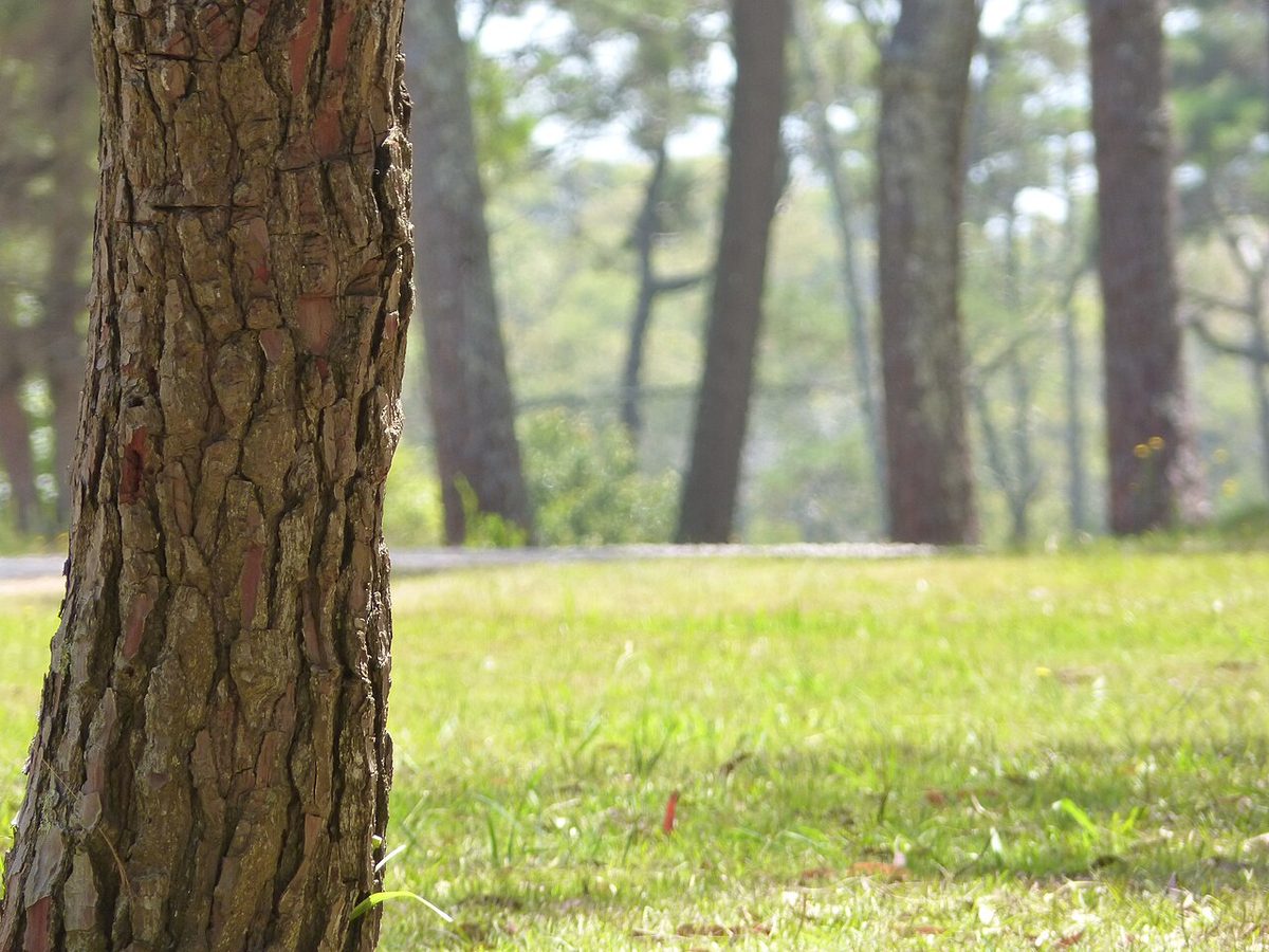
Camping is the heart of Santa Teresa, and it is unlike any campground I have used elsewhere. The word camping in Uruguay just means a campsite, but this one is on an industrial scale: somewhere around 1,600 marked plots scattered through the planted forest, with a stated capacity of up to 10,000 people. In the dead of January that capacity is not theoretical. It fills.
What makes it work is the forest itself. Arredondo’s pines and eucalyptus give almost every plot real shade, which on a 30-degree Rocha afternoon is the difference between a holiday and a slow roast. The sites are spread across several zones threaded with sandy lanes, and the experience varies a lot depending on where you land. Some plots are rustic, just a cleared patch under the trees. Others sit in zones with electricity and water laid on. Closer to the central services you get more bustle and noise; push out toward the edges and it quietens down considerably.
The services are surprisingly complete for a campground in the middle of a national park. Over the years it has run a supermarket, bakery, restaurants, an auto mechanic and even a tyre shop, plus toilet and shower blocks and basic urgent medical and dental cover in peak season. You are camping, but you are not exactly off-grid.
How it works and what it costs
Entry to the park is free, but to stay overnight you have to register as a camper at the entrance and pay the nightly rate. Pricing is per the setup you choose and shifts year to year, but as a rough hedge, budget on the order of USD 10 to 15 per night for a plot, more for a serviced site, and confirm directly before you go. The army parks service handles bookings, and there is a WhatsApp line that has worked well for me in the past (around +598 4477 2103). In peak season you genuinely need to reserve or arrive early; this is not a place where you can rock up at 6pm on 2 January and expect a shady plot.
If a tent is not your idea of a holiday, the park also rents out houses and what locals call carpicabanas, simple cabins, some of them with sea views, plus there is a hostel inside the park with shared dorms and twin rooms. These book out furthest in advance of anything.
Here is my honest drawback, and it is the big one: in January this campground is rustic and very crowded. The shade is glorious and the setting is genuine forest, but you are sharing it with thousands of Uruguayan and Argentine families, the central zones get loud well into the night, and the bathroom blocks take a beating. If your mental image of “camping in a national park” is solitude and birdsong, come in late spring or autumn instead. For the trade-off between the two, our notes on the best time to visit Uruguay are worth a read.
The beaches: twelve kilometres, four moods
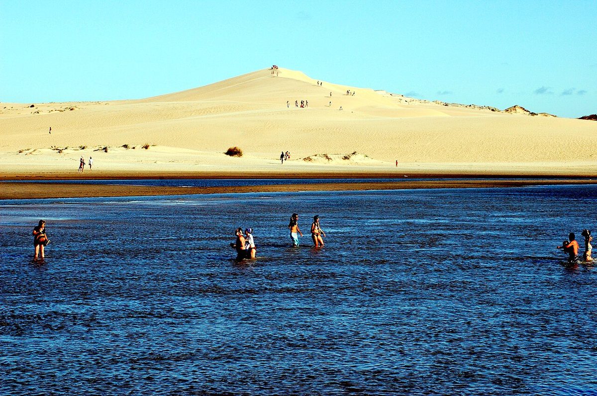
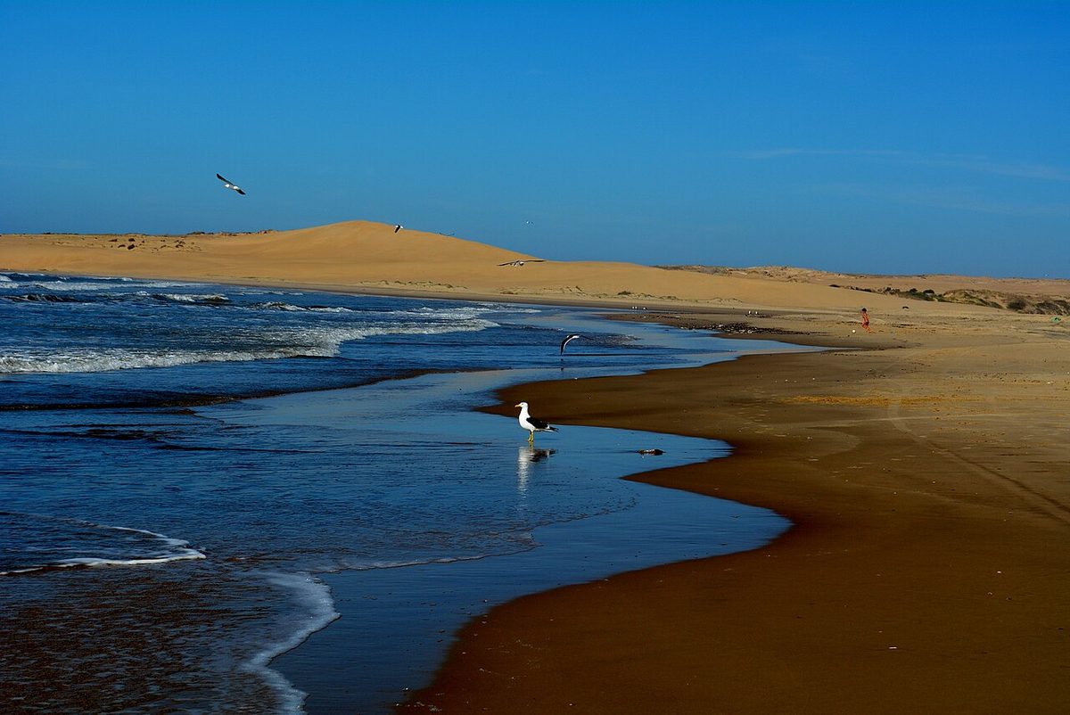
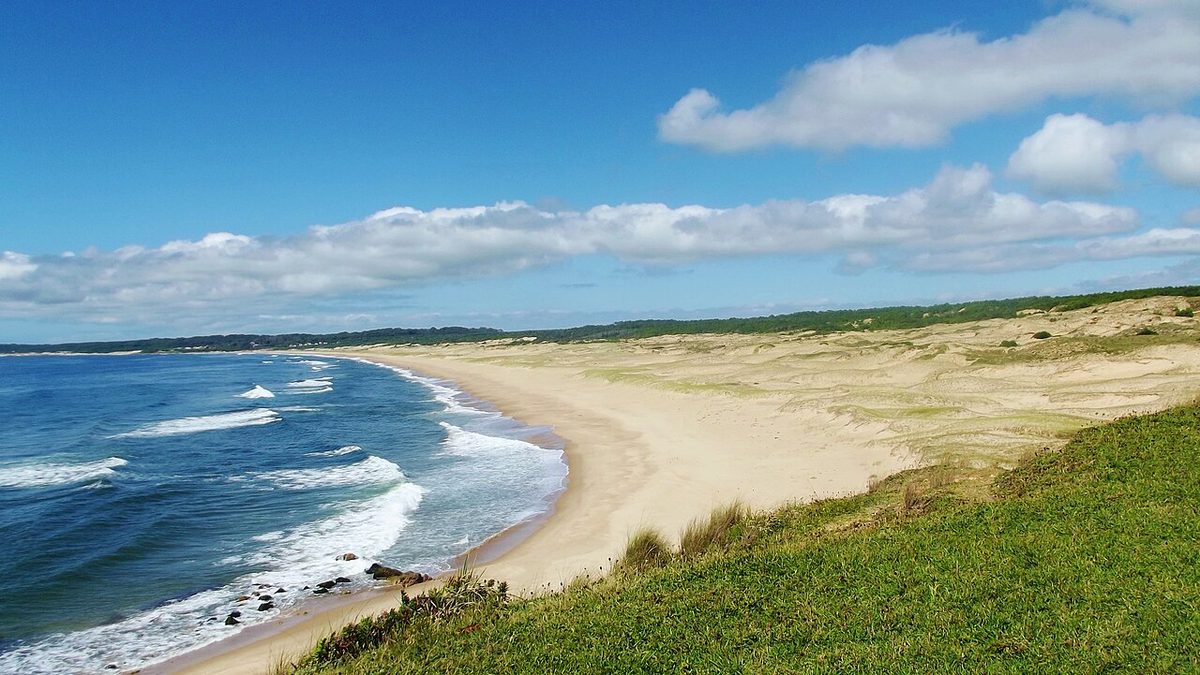
Santa Teresa has about twelve kilometres of Atlantic coast, running from Cerro Verde in the north down to Punta del Diablo in the south, and it is one of the better stretches of Uruguay’s beaches precisely because the park keeps it undeveloped. No high-rises, no beach clubs, just dunes, forest behind and a lot of open sand. There are four main beaches and they each have a distinct character.
Playa Grande is the long one at the southern end, bordering Punta del Diablo. It is the easiest to reach and the most popular, a wide sweep of sand that absorbs a crowd well. This is where most day-trippers and campers end up, and in summer it gets busy near the access points, though it is long enough that a ten-minute walk usually buys you space.
Playa la Moza, a little north, has the reputation. Its waves are rated among the best for surfing in Uruguay, so this is where you will find boards in the water and a younger crowd. The fort sits about 800 metres inland from here, which makes La Moza a natural pairing: surf in the morning, fort in the afternoon. The swimming can be lively, so it is not the gentlest spot for small children.
Playa Achiras is the accessible, family-friendly option, easy to get to and with a reputation for good fishing off the rocks. Playa del Barco, the “beach of the boat,” is the quietest of the four and the one I send people to when they want to be alone. It is the least crowded, partly because some of the houses along it are reserved for military personnel, and there has historically been a whale-watching post here, because southern right whales pass offshore in late winter and spring.
Between the beaches you get rocky headlands, the promontories the old legend turned into petrified sirens, and small coves that are good for a quiet sit. One drawback worth naming: these are open-ocean beaches with real surf and currents, lifeguard cover is seasonal at best, and the water is properly cool outside high summer. Lovely to look at in June; bracing to swim in.
If you want to range further along this coast, Santa Teresa’s beach-town neighbours are all within an easy drive. Punta del Diablo is right next door and the obvious base. South of that lie Cabo Polonio, the off-grid one reachable only by 4×4 (our guide on how to get to Cabo Polonio explains that ride), the dunes of Barra de Valizas, the surf town of La Pedrera and the bigger resort of La Paloma.
Gardens, nursery and wildlife
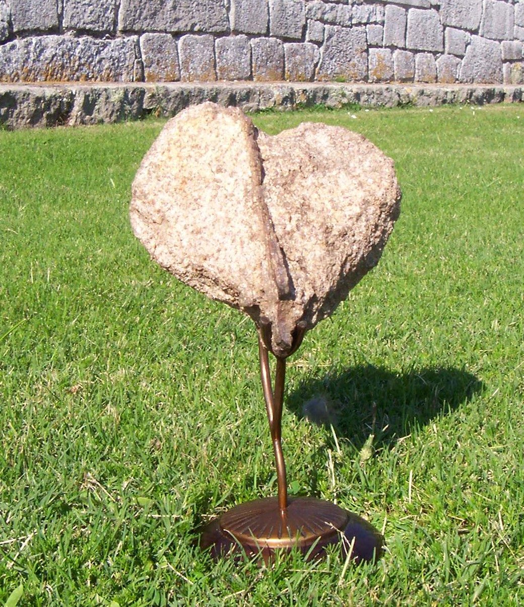
People come to Santa Teresa for the fort and the beaches and then end up spending an unexpectedly happy hour among the plants. The botanical side of the park is one of Arredondo’s other legacies, and it is far more elaborate than a national campground has any right to be.
The rosaleda, or rose garden, is the standout. It holds more than 300 classified varieties of rose, and it is considered unique in Uruguay for the sheer breadth of that collection. Time your visit for late spring, roughly November, and it is at its best. The invernaculo, the greenhouse built in 1939, is a granite-and-glass structure with controlled heat and humidity that grows tropical flora from five continents, with a small aquarium and ponds of koi carp inside. Next to it the sombraculo, a “shaded house” from the same year, shelters tropical species under a lattice of filtered light, with ponds of papyrus and water lilies. There is also a working vivero, a plant nursery, which is the engine room that has kept the whole forest supplied with seedlings for a century.
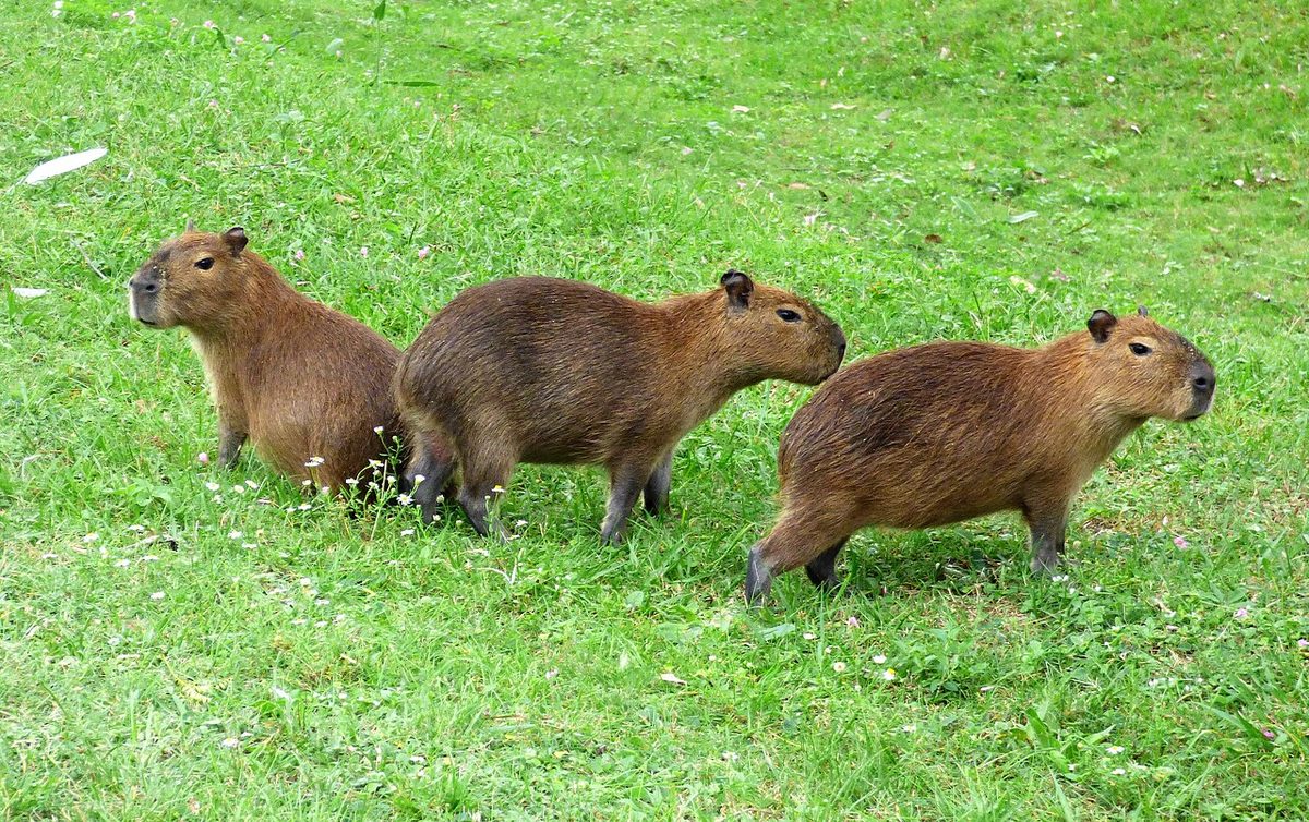
For wildlife, head to the area around the Pajarera, an aviary and refuge that cares for endangered birds, breeds them and returns them to the wild, alongside other rescued mammals and reptiles. In front of it is a wetland you cross on footbridges, dotted with playgrounds and picnic tables, where you can see capybaras, otters, deer, yacare caimans, turtles and a noisy population of free-roaming peacocks. The big draw for naturalists, though, is the Laguna de Pena, reached by a boardwalk to a viewpoint. It holds what is reckoned to be Uruguay’s largest reserve of carpinchos (capybaras), plus axis deer, otters and a long list of birds: the prehistoric-looking chaja, white and black herons and many more. Bring binoculars, and go early or late.
One more spot to find on a hot day is El Chorro, a stone construction that channels a natural spring into a pool you can bathe in, set in thick greenery near the park’s central services.
The bird and animal life is reason enough to fold Santa Teresa into a wider conservation-minded trip; if that is your angle, our overview of Uruguay’s national parks sets it in context.
Nearby: Cerro Verde, La Coronilla, San Miguel and the border
Santa Teresa is not an island, and some of the best half-days are just outside it.
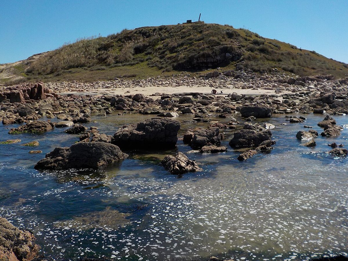
Immediately north sit Cerro Verde and La Coronilla, a protected coastal-marine area with a low green hill, a viewpoint for watching sea life, and quiet beaches that see a fraction of the crowds further south. It is a short hop and worth it for the contrast: where Santa Teresa is planted forest, Cerro Verde is wind-scoured headland.
About 30 kilometres north, near the town of Chuy, stands the Fuerte San Miguel, Santa Teresa’s smaller sibling fort, also restored by Arredondo, sitting amid wetlands close to the frontier. If you have enjoyed the Fortaleza de Santa Teresa, San Miguel makes an obvious companion visit, and the two together tell the full story of this contested colonial border.
And then there is the border itself. Chuy is a genuine oddity: a town split down the main street between Uruguay and Brazil, where one pavement is Uruguayan and the other is Brazilian (Chui, in Portuguese). People go for the duty-free shopping and the slightly surreal feeling of stepping between two countries on a single street. It is about 35 kilometres from the park and an easy add-on if you have a car.
Planning your visit by traveller type
How you should approach Santa Teresa depends a lot on who you are and how you arrive.
Campers
This is your park. Book or arrive early, choose a serviced plot if you want power and an easier time, and aim for an edge zone if you value quiet over convenience. Bring everything: while there is a supermarket on site, prices and stock are campground prices and campground stock. A stove, plenty of water containers and good shade-friendly gear go a long way. Outside January, you may have whole stretches of forest almost to yourself.
Families
Santa Teresa is excellent for kids, which is why so many Uruguayan families have made it a generational tradition. The wildlife refuge, the peacocks wandering the paths, the El Chorro pool and the gentle reaches of Playa Achiras keep children busy, and the campground’s services take the edge off travelling with little ones. Just mind the open-ocean surf on the swimming beaches: this is excellent terrain for children as long as an adult watches the water. Our guide to Uruguay with kids covers the rest of the country from a parent’s point of view.
Day-trippers
If you are based in Punta del Diablo, Santa Teresa is an easy day out, and you can cover the highlights, fort, a beach, the gardens and the refuge, in a single visit. Come on a day the fort is open, get there when the gates do, and you will beat the heat and most of the crowds.
Getting there and getting around
Here is the practical reality, and it is my second honest drawback: you really want a car. The park entrance is on Route 9 around km 302, but the campground, the fort, the gardens and the beaches are spread over several kilometres of internal roads, some of them ripio (loose gravel). Long-distance buses with companies like COT, Rutas del Sol and Cynsa will drop you at the park entrance, and in season there are vans that shuttle the roughly four kilometres in to the camping area, but without your own wheels you will spend a lot of the day walking or waiting. Renting is the simplest fix; our notes on renting a car in Uruguay cover the paperwork, and Santa Teresa slots neatly into a wider Uruguay road trip up the Atlantic coast.
Where to stay
Inside the park it is camping, cabins or the hostel, full stop. For an actual bed, base yourself in Punta del Diablo, ten kilometres south, which has the widest range of hostels and rental houses and the easiest access. The quieter town of Castillos, about half an hour inland, has a few guesthouses and a more local feel. La Coronilla, just north, is another low-key option. Our broader guide to where to stay in Uruguay can help you slot this into a longer trip.
Santa Teresa National Park Uruguay: your questions answered
Is Santa Teresa National Park worth visiting?
Yes, and especially if you can give it more than a couple of hours. The combination of a genuinely impressive restored colonial fortress, twelve kilometres of undeveloped Atlantic beach, an elaborate rose garden and greenhouse, and a wildlife refuge full of capybaras and peacocks is unusual for one site. Outside the January crush, it is one of the most rewarding stops on Uruguay’s eastern coast.
How much does it cost to enter Santa Teresa National Park?
Entry to the park itself is free. The Fortaleza de Santa Teresa charges a small separate fee, historically around 40 to 50 Uruguayan pesos (well under USD 2). Camping is the real cost: budget roughly USD 10 to 15 per night per plot as a rough hedge, more for serviced sites or cabins. Confirm current prices with the army parks service before you travel.
Can you camp in Santa Teresa National Park?
Yes, and it is the main way to stay. The campground has around 1,600 forested plots and can hold up to 10,000 people, with both rustic and serviced (electricity and water) zones, plus rental cabins and a hostel. You must register as a camper at the entrance and pay the nightly rate. In peak summer you should reserve in advance or arrive very early to get a good plot.
How do you get to Santa Teresa National Park?
By car, take Route 9 to around km 302 in the Rocha department; it is roughly 300 kilometres northeast of Montevideo and about 10 kilometres north of Punta del Diablo. Long-distance buses (COT, Rutas del Sol, Cynsa) stop at the park entrance, and seasonal vans run the four-or-so kilometres in to the campground. Given how spread out the park is, a car makes the visit far easier.
Who runs Santa Teresa National Park?
The National Army of Uruguay, through its parks service (Servicio de Parques del Ejercito, SEPAE). The army has managed the site since the era of its restoration in the early 20th century, which is why you will see military involvement in everything from the fort to parts of the campground and some of the houses along Playa del Barco.
What is there to do besides the beach?
Plenty. Tour the Fortaleza de Santa Teresa and its museum, walk the rose garden, greenhouse and shaded house, visit the wildlife refuge and the Laguna de Pena capybara reserve, bathe at the El Chorro spring pool, and birdwatch through the forest and wetlands. Nearby you can add Cerro Verde, the Fuerte San Miguel and the Brazilian border at Chuy.
Final thoughts
Santa Teresa is the rare park that works on two completely different settings. Visit in January and it is a loud, sociable, very Uruguayan summer institution, ten thousand people camping under the pines, kids and surfboards and asado smoke. Visit in October or April and it is something close to solitude: an empty fort on its rocky rise, a rose garden between blooms, beaches with nobody on them but the whales offshore. Both are worth doing. Just go in knowing which one you have signed up for, bring a car, and give Arredondo’s strange, wonderful forest the day it deserves.
Credits & sources
Sources & further reading
- Turismo Rocha: Santa Teresa National Park
- Wikipedia: Fortaleza de Santa Teresa
- Wikipedia: Santa Teresa National Park
- Servicio de Parques del Ejercito (army parks service)
Photo credits
All images via Wikimedia Commons: Fortaleza Santa Teresa Rocha Uruguay by Fernandapladauru (CC BY-SA 3.0); Fortaleza Santa Teresa Walls by Ubirajara Buddin Cruz (CC BY-SA 3.0); Santa Teresa Campground Forest by Eca2107 (CC BY-SA 3.0); Playa Grande Santa Teresa Uruguay by Micaela Villanueva Capdevielle (CC BY-SA 3.0); Santa Teresa Capybaras Rocha by Enrique González (CC BY-SA 4.0); Santa Teresa Corazon Garden by Carlos Ferrer Olmedo (CC BY-SA 4.0); Cerro Verde La Coronilla Coast Rocha by Pablo Bounous (CC BY-SA 3.0).