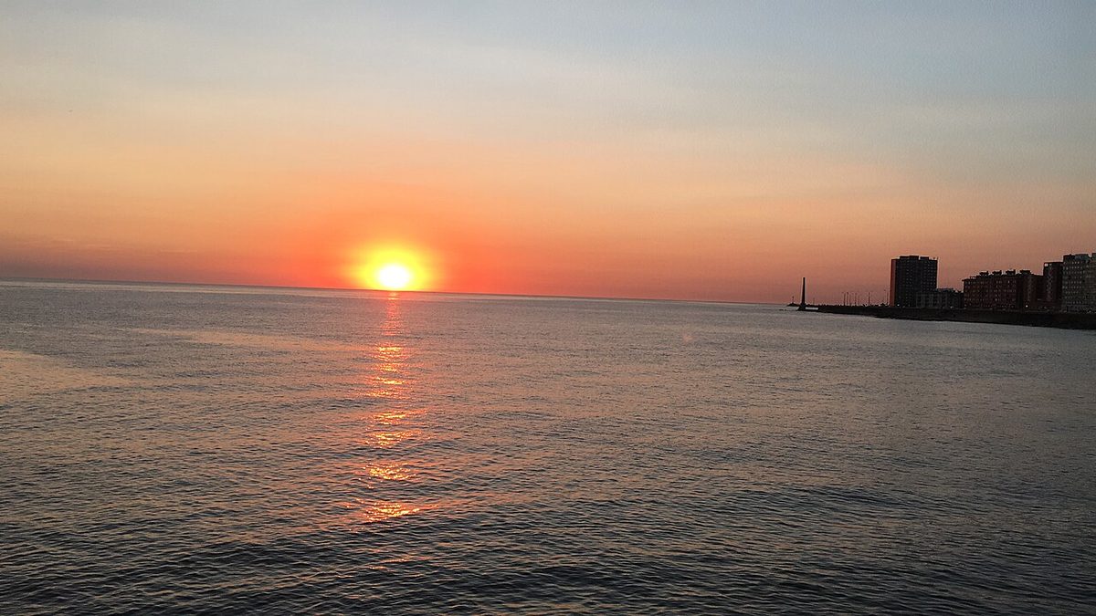
Uruguay Road Trip: The Route 10 Coastal Drive (2026)

The first time I drove Ruta 10 east of Punta del Este, I almost missed the turn for José Ignacio because I was busy gawking at the lagoon on my left. That is the problem with this road. The scenery keeps trying to pull the wheel out of your hands, and the asphalt occasionally gives way to washboard gravel without much warning, and then a string of horses ambles across at La Pedrera like they own the place. I loved every minute of it.
A Uruguay road trip down the coast is, to my mind, the single best way to see this country on your own terms. You trade the rigid timetable of a bus for the freedom to stop at an empty beach because the light looked good, to detour inland for a parrilla (grill restaurant) lunch, to linger over sunset at a lighthouse instead of sprinting for the last departure. The catch is that “the coast road” is not one tidy highway. It is a stitched-together sequence of Ruta Interbalnearia, Ruta 10, and a few stretches of bumpy ripio (unpaved gravel road) that will rattle your fillings.
I have driven most of it more than once, in a hatchback and in a borrowed SUV, in January chaos and in quiet April. This guide is the version I wish someone had handed me the first time: where to stop, how long each leg actually takes, and the unglamorous mechanics nobody writes about in English.
So, what exactly is a Uruguay road trip down Ruta 10? It is a self-drive route along the Atlantic coast, roughly Montevideo east to the Brazilian border, using Ruta Interbalnearia and Ruta 10 to link beach towns like Atlántida, Piriápolis, Punta del Este, José Ignacio, La Paloma, Cabo Polonio, and Punta del Diablo. Plan three to seven days, rent a car in Montevideo or Punta, and budget for tolls, fuel, and a few gravel sections.
This is a driving and logistics guide, not a day-by-day plan. I cover the stops in order, the real distances and drive times, and the practical stuff: renting a car, ripio, tolls, fuel, parking, the famous circular bridge, and summer traffic. If you want a rigid hour-by-hour schedule, I will point you to our full itineraries instead. If you want to understand how to actually drive this coast, you are in the right place.
| Segment | Distance / drive time | Why stop |
|---|---|---|
| Montevideo → Atlántida | ~50 km / 45 min | Easy first beach town; the Aguila eagle sculpture; coffee before the open road |
| Atlántida → Piriápolis | ~50 km / 50 min | Old-world seafront, the Argentino hotel, chairlift up Cerro San Antonio |
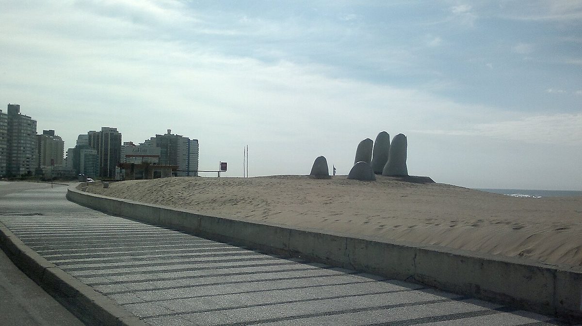
| Piriápolis → Punta del Este | ~45 km / 45 min | The big resort: the Hand sculpture, the port, the peninsula, restaurants |
| Punta del Este → La Barra | ~10 km / 15 min | The undulating wave bridge, boutiques, a younger night scene |
| La Barra → José Ignacio | ~25 km / 30 min | The chic fishing village, the lighthouse, long quiet beaches |
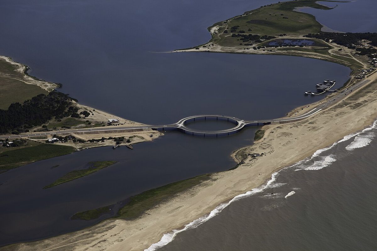
| José Ignacio → La Paloma (via Laguna Garzón bridge) | ~70 km / 1 hr 15 min | The circular bridge, the start of wild Rocha, surf town energy |
| La Paloma → La Pedrera | ~10 km / 15 min | Clifftop village, bohemian feel, two great beaches |
| La Pedrera → Cabo Polonio | ~40 km / 50 min + 4×4 shuttle | Off-grid dunes; you park and ride in, no private cars |
| Cabo Polonio → Punta del Diablo | ~50 km / 1 hr | Fishing-village-turned-backpacker-hub, big beaches, seafood |
| Punta del Diablo → Santa Teresa / border | ~10–35 km / 15–40 min | National park, fortress, pines to the sand, last stop before Brazil |
Why drive Ruta 10 instead of taking the bus
Uruguay’s bus network is genuinely good. You can reach almost every town on this list by COT, Copsa, or Rutas del Sol, and for a single destination I often do. But the coast strings together a dozen places that buses connect awkwardly, with transfers in Maldonado or San Carlos and schedules that thin out the further east you go.
A car collapses all of that. The drive from José Ignacio to Cabo Polonio that eats half a day by bus becomes a relaxed ninety-minute cruise with a beach stop. You can carry a cooler, surfboards, a tent. You can stay somewhere cheaper a few kilometers inland and not care.
The honest drawback: a rental car is expensive in peak summer, parking in Punta del Este in January is its own small ordeal, and two of the best places on this route, Cabo Polonio and the heart of old-town Punta, are not places you actually drive into. You will park and walk or take a shuttle. If your trip is only Montevideo plus one beach, skip the car entirely and read our guide to getting from Montevideo to Punta del Este the easy way. For everything from José Ignacio eastward, though, a car changes the trip.
For the bigger picture of how flights, the Buenos Aires ferry, buses, and driving fit together, our overview of getting to Uruguay and around lays out the options before you commit to a rental.
Renting a car for your Uruguay coastal road trip
You can pick up a car at Carrasco airport in Montevideo, in the city center, or at Punta del Este’s small airport and downtown offices. The international chains are all here (Hertz, Avis, Europcar, Localiza) along with local outfits that are sometimes cheaper. I have used both and had no real trouble either way. If you are arriving from Buenos Aires, rent on this side rather than bringing a car over on the boat; taking a vehicle across is expensive and rarely worth it, and our combined Argentina and Uruguay itinerary covers the crossings and the terminals.
Bring your home driving license. For most Western visitors that is accepted for tourist stays, though an International Driving Permit is cheap insurance against a confused official and I usually carry one. You will need a credit card for the deposit and you must be the named driver.
What it costs, roughly
Off-season, a small manual hatchback can run around USD 35 to 50 a day. In January that same car can double or worse, and the cheap categories sell out, so book well ahead if you are driving the coast in peak summer. Automatics cost more and are scarcer; if you cannot drive a manual, reserve early.
Check whether the quote includes full insurance or just the legal minimum. The cheap rate online often carries a big excess. I pay for the better coverage on the coast specifically because of the gravel, which brings me to the part everyone underestimates.
The ripio question, and your car category
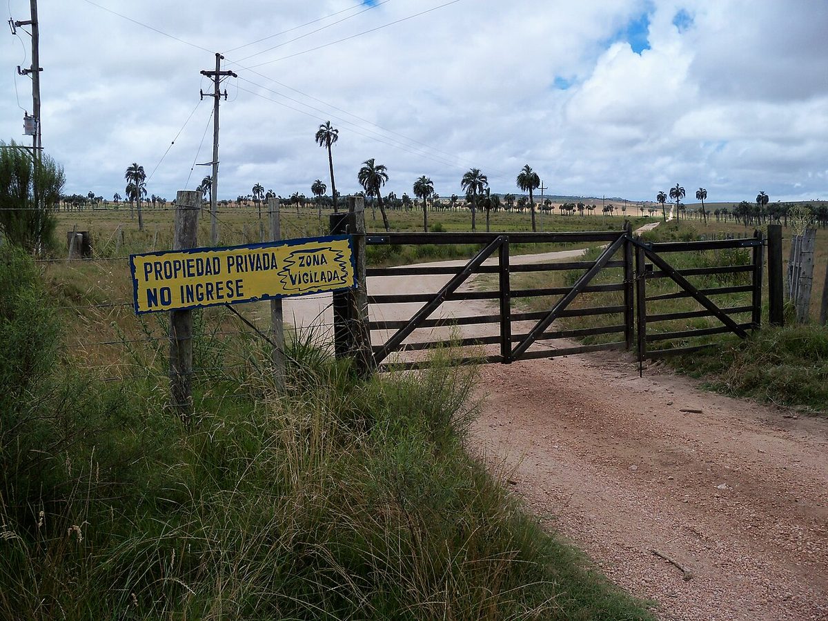
Ripio is loose gravel, and parts of Ruta 10 in Rocha, plus most access roads to the wild beaches, are ripio rather than asphalt. A normal car handles it if you slow down. You do not need a 4×4 for the route itself.
What you do need is to read your contract. Some rental companies technically prohibit driving on unpaved roads, or void tire and windscreen cover there. Flying stones crack windscreens, and a punctured tire on ripio is a genuinely common rental claim. Ask directly, get the answer in writing if you can, and consider the higher insurance tier. I have seen travelers handed a surprise bill for a chipped windscreen they did not know was excluded.
The drive, stop by stop
Here is how I actually string the coast together heading east from Montevideo. Treat the order as fixed and the stops as a menu; you will not do all of them on a short trip.
Montevideo to Atlántida and the Costa de Oro
Leaving Montevideo you take Ruta Interbalnearia, the fast dual carriageway that does the heavy lifting between the capital and Punta. The first hour runs past the Costa de Oro, a ribbon of low-key balnearios (beach resorts) like Atlántida, Las Toscas, and Cuchilla Alta where Montevideanos have summer houses.
Atlántida makes a gentle first stop: a proper little town, a long beach, and the strange concrete Aguila (eagle) on the sand that everyone photographs. It is a good place to caffeinate, double-check your tire pressure, and settle into the trip before the scenery gets serious. None of this stretch is on the coast-hugging Ruta 10 yet; you are on the inland highway and not missing much by staying on it.
Piriápolis: the grandmother of Uruguayan resorts
Piriápolis is where the drive starts to feel special. Built a century ago as one man’s dream resort, it has a curved seafront promenade, the grand old Argentino Hotel, and a backdrop of green hills. Take the chairlift up Cerro San Antonio for the view, or drive the loop past Punta Fría toward Portezuelo where Ruta 10 properly begins to trace the shore.
The town feels a generation older than Punta del Este, in a good way. Prices are gentler, the crowd is more Uruguayan families than international jet set, and the seafood lunch I had at a no-name spot on the rambla (waterfront promenade) is still one of my favorites on the coast.
Punta del Este: the resort you cannot skip (or can you?)
Punta del Este is the gravitational center of the Uruguayan coast, and roughly halfway along the classic route. You will hit the famous concrete Hand (La Mano) emerging from Playa Brava, the working port with its sea lions, and the peninsula where the calm Mansa side meets the wavy Brava side. Our deep dive on Punta del Este covers what is worth your time and what is overhyped.
Driving here is the one genuinely annoying part of the whole road trip. In January the peninsula’s grid clogs, parking near the port vanishes, and the meter wardens are efficient. My advice: stay outside the densest core, drive in, park once, and walk. If you only want a sense of the place, the Hand and a sunset drink on the Mansa take an afternoon and you can sleep further east where parking is free.
La Barra and the wave bridge
Just east of Punta, Ruta 10 crosses the Arroyo Maldonado on the bridge everyone remembers: a pair of humped, undulating spans that you ride like a gentle rollercoaster. Take it slowly the first time, partly for fun and partly because the dip genuinely lifts your stomach.
On the far side is La Barra, the bohemian, boutique-lined alter ego of glossy Punta. It is busier and younger at night, good for browsing and ice cream, and it marks the point where the coast starts to open up and quieten down.
José Ignacio: where the road gets beautiful
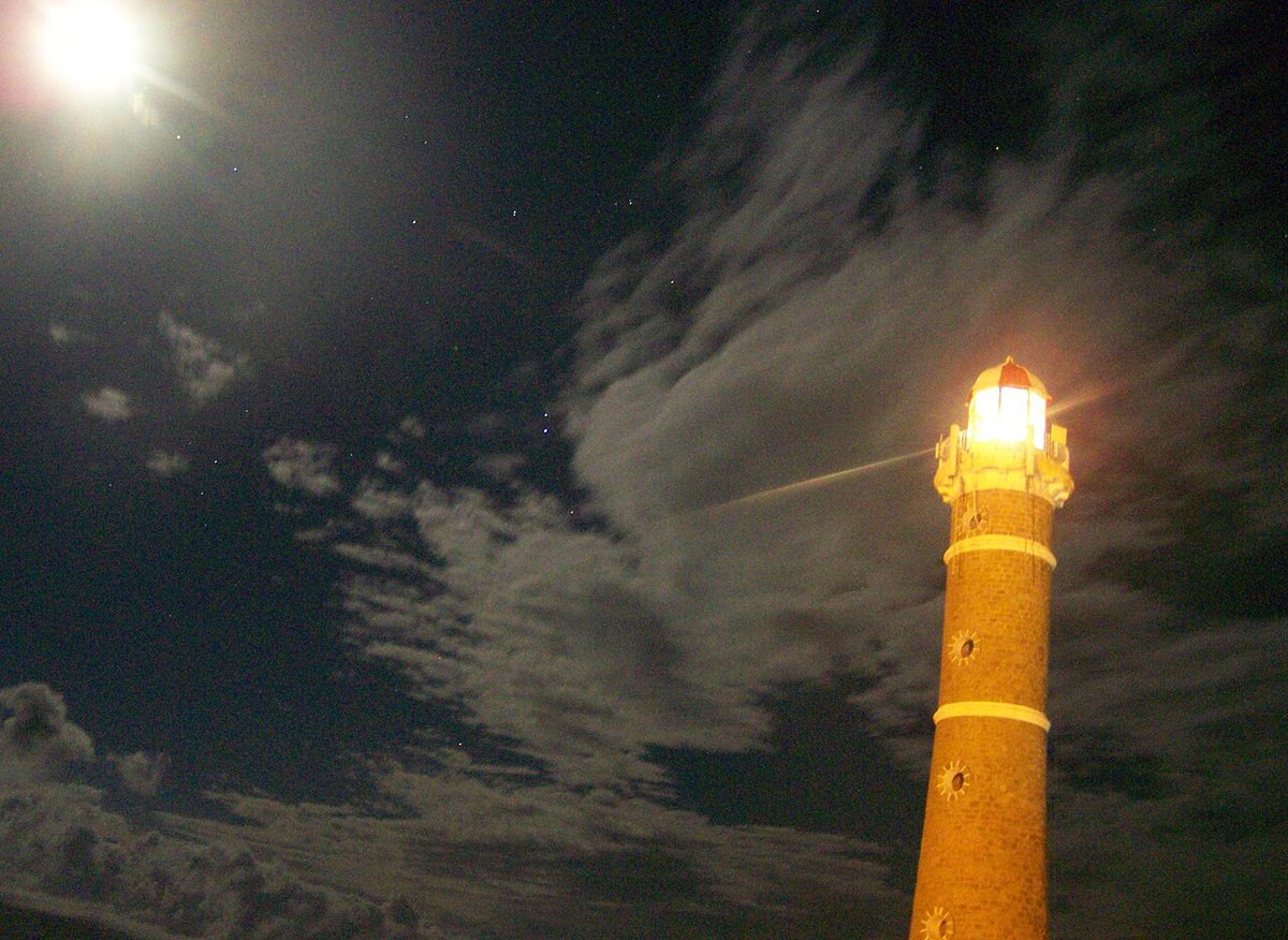
From La Barra, Ruta 10 runs along an increasingly wild shoreline to José Ignacio, a former fishing village turned barefoot-chic enclave around a stubby lighthouse. This is my favorite stretch to actually drive: scrubby dunes on one side, long empty beaches on the other, and very little traffic once you are past the Manantiales junction.
José Ignacio rewards an overnight if your budget allows, but even a lunch and a walk to the lighthouse are worth the detour. After this, the asphalt gets thinner and the coast gets wilder. You are leaving Maldonado and entering Rocha, the part most foreign visitors never reach. Our day-by-day Rocha coast itinerary gives this stretch the five to seven days it deserves.
The Laguna Garzón bridge: that circular one
Right after José Ignacio, Ruta 10 meets the Laguna Garzón, the lagoon that marks the Maldonado–Rocha border. Crossing it is, no exaggeration, one of the more memorable bits of driving in South America, because the bridge is a perfect circle.
The ring shape is deliberate. It forces you to slow to about 15 km/h as you curve around, which calms traffic, gives you a 360-degree view of the lagoon, and is far prettier than a straight span. There is a small toll to cross. Drive the ring slowly, enjoy it, and resist the urge to stop on the bridge itself, which is not allowed.
La Paloma and La Pedrera: the start of the wild coast
Past the lagoon you are firmly into Rocha, and the vibe shifts from polished to salty. La Paloma is a workmanlike surf and family town with a lighthouse and beaches facing several directions, so there is usually somewhere sheltered from the wind. It is a practical base with supermarkets and fuel before the off-grid stretch.
A few minutes on is La Pedrera, smaller, set on low cliffs, and one of those places I keep meaning to stay longer. Its two main beaches, the calm one and the dramatic surfy one, are a short walk apart. For where these fit among the country’s coastline, our guide to the best beaches in Uruguay is the place to compare.
Cabo Polonio: the place you cannot drive into
Cabo Polonio is the strangest and best stop on the whole route, and it comes with the road trip’s biggest asterisk. You cannot drive your rental car to the village. The settlement sits inside a national park, has no mains electricity, and is reached only by a fleet of big-wheeled 4×4 trucks that bounce across several kilometers of dunes and forest from the entrance on Ruta 10.
So you park at the official lot by the highway, pay for a round-trip ticket, and ride in standing room and all. It is bumpy and slightly absurd and completely worth it. Once there you have wind, a candle-lit lighthouse, a sea lion colony, and a sky full of stars. Bring cash, plan your return shuttle, and do not expect ATMs or reliable signal.
This is the one stop where forgetting the rules can derail your day, so build the shuttle timing into your plan. If off-grid corners are your thing, you will find more of them in our roundup of Uruguay’s lesser-known places.
Punta del Diablo and Santa Teresa
The last leg runs to Punta del Diablo, a fishing village that became a backpacker and surfer favorite without entirely losing its rough edges. Sandy lanes, seafood shacks, big open beaches, and a budget-friendly scene make it a fitting end to the coast. Note that some of the access streets in the village itself are sand, not asphalt, so park sensibly and walk.
Just beyond is Parque Nacional Santa Teresa, where pine forest runs almost to the sand and a colonial-era fortress sits on a hill. It is one of Uruguay’s better national parks and the natural turnaround point, a few kilometers short of the Brazilian border at Chuy. From here you either loop back or cross into Brazil; either way you have driven the whole coast.
The driving mechanics nobody explains
The stops are the fun part. The reason most English-language guides leave you guessing is the operational detail, so here is the part I really want you to read.
Tolls (peajes)
Uruguay has toll plazas (peajes) on its main highways, including Ruta Interbalnearia between Montevideo and the Punta del Este area. They are not expensive by international standards, a few US dollars each, but you hit a couple on the way east.
Most peajes take cash in Uruguayan pesos and cards, and there is an electronic tag system (Telepeaje) that locals use. As a tourist in a rental you will usually just pay at the booth, so keep some pesos in the door pocket. The Laguna Garzón bridge also has its own small crossing fee.
Fuel and ANCAP
Fuel in Uruguay is sold mostly through ANCAP, the state oil company, whose blue-and-white stations you will see everywhere, along with some Petrobras and DISA. Stations are full-service: an attendant pumps for you, and a small tip is normal but not required.
Prices are not cheap here, noticeably higher than in Argentina or the US, so factor fuel into the budget. More importantly, fill up before the wild stretch. East of La Paloma stations thin out, and you do not want to be hunting for diesel near Cabo Polonio at dusk. My rule on the coast is simple: if I pass a station below half a tank in Rocha, I stop.
Driving in summer traffic
From mid-December through January the coast fills up, and the roads feel it. Ruta Interbalnearia gets heavy on summer Fridays and Sundays, the approaches to Punta del Este crawl, and beach-town parking becomes competitive sport. If you can, drive between towns mid-morning or mid-afternoon rather than at the peak in-and-out times.
Outside summer the whole coast empties out and driving becomes a pleasure, which is a big argument for shoulder season. Our breakdown of the best time to visit Uruguay goes deeper, but for a driving trip specifically, late spring and early autumn are the sweet spot: warm enough, open roads, easy parking.
Parking and a few rules of the road
Uruguayans drive reasonably calmly compared with some neighbors, but a few things will trip you up. Seatbelts and daytime headlights are mandatory on highways. The blood-alcohol limit is effectively zero, so do not drink and drive at all. Speed limits are enforced, and the police do run checkpoints, especially in summer; have your documents handy and you will be waved through.
For parking, the beach towns use paid street parking in season, sometimes via an app or a paper ticket, sometimes via informal attendants who watch your car for a tip. In Punta del Este, pay the meter; the wardens are real. Elsewhere, common sense and a small tip cover it.
How long do you need, and where to sleep
You can technically blast Montevideo to Punta del Diablo in a single long day, but that wastes the entire point. I think the coast deserves a minimum of three days and is happiest with five to seven. With only a weekend, you will get more out of picking a single base for three days in Uruguay than out of a rushed run east.
A tight version, three or four days, gets you Montevideo, a night around Punta or José Ignacio, and a night in Rocha near Cabo Polonio or Punta del Diablo. A relaxed week lets you add Piriápolis, linger in José Ignacio, and give the wild coast the slow time it deserves. For full schedules with nights mapped out, see our broader Uruguay itinerary planner, our 7-day Uruguay itinerary and the longer 10-day route that adds wine country and the interior; this article is meant to ride alongside them, not replace them.
For where to base yourself at each stop, from glossy Punta to off-grid Cabo Polonio, our guide on where to stay in Uruguay breaks it down region by region. And if you are still deciding whether to commit a whole trip to driving the coast at all, the honest verdict in is Uruguay worth visiting is a fair gut check.

One honest drawback of the Ruta 10 road trip
I want to be straight with you, because most guides are not. The coast road is not a single smooth scenic highway like California’s Highway 1. It is a patchwork. Some of the prettiest sections in Rocha are ripio that will slow you to a crawl and ding your windscreen if you are unlucky. The two best stops, central Punta and Cabo Polonio, are precisely the ones you do not drive into. And in peak summer, traffic and parking can sap a chunk of the freedom a car is supposed to buy you.
None of that stops me recommending it. It just means you should drive it with the right expectations: a manageable amount of gravel, a couple of tolls, a shuttle or two, and fuel planning in the east. Do that and the Ruta 10 coast is, for me, the most rewarding self-drive in the country.
Uruguay road trip: your questions answered
Do I need a 4×4 to drive the Uruguay coast?
No. A normal car handles Ruta 10 and the access roads if you slow down on the ripio. The only place you genuinely need a 4×4 is the dune crossing into Cabo Polonio, and you do not drive that yourself; you ride the official shuttle trucks from the highway entrance.
How many days do you need to drive Route 10 in Uruguay?
Three days is the realistic minimum to enjoy it, covering Montevideo, Punta or José Ignacio, and one stop in Rocha. Five to seven days is far better and lets you add Piriápolis and give the wild coast around Cabo Polonio and Punta del Diablo the unhurried time it deserves.
Is it safe to drive in Uruguay as a foreigner?
Yes, generally. Uruguay is one of the safer countries in the region to drive, roads are decent, and drivers are relatively calm. Watch for ripio sections, a strictly enforced near-zero alcohol limit, and summer police checkpoints. Carry your license and rental papers and keep some pesos for tolls.
Can you drive from Montevideo to Punta del Este?
Easily. It is about 130 km on Ruta Interbalnearia, roughly an hour and forty-five minutes without traffic, with a couple of small tolls. In peak summer it takes longer. If you only want this one leg and not a full coastal drive, our dedicated guide to Montevideo to Punta del Este covers the bus and shuttle options too.
What is the Laguna Garzón bridge and do I have to cross it?
It is a circular bridge on Ruta 10 between José Ignacio and La Paloma, designed as a ring to slow traffic and protect the lagoon. If you are driving the coast east into Rocha, yes, you cross it; there is a small toll. The alternative inland route is longer and far less scenic.
Final thoughts
If you only do one self-drive in Uruguay, make it this one. The Ruta 10 coast packs a century-old resort, the country’s flashiest beach town, a circular bridge, an off-grid village with no electricity, and miles of empty Atlantic sand into a few easy days behind the wheel.
Go in with clear eyes about the gravel, the tolls, and the two stops you park-and-walk into, and you will spend less time stressed and more time pulling over for sunsets. Rent the car, buy the better insurance, fill up before Rocha, and drive it slowly. The road will do the rest.
Credits & sources
Sources & further reading
- Ministerio de Turismo del Uruguay — the national tourism ministry’s official site.
- Ministerio de Transporte y Obras Públicas — for roads, tolls, and infrastructure information.
- ANCAP — Uruguay’s state fuel company, useful for station locations and prices.
Photo credits
All images via Wikimedia Commons: Ruta 10 Coast Uruguay by TitiNicola (CC BY-SA 4.0); Ripio Gravel Road Rocha by butiacero (CC BY-SA 3.0); La Mano Punta Del Este by Paola15 (CC BY-SA 3.0); Laguna Garzon Circular Bridge by Jimmy Baikovicius from Montevideo, Uruguay (CC BY-SA 2.0); Punta Del Diablo Beach by rodoluca (CC BY-SA 3.0).