Uruguay Hidden Gems: 15 Places Most Tourists Miss (2026)
Most people come to Uruguay and leave having seen three places: Punta del Este, Colonia del Sacramento, and Montevideo. All three are worth your time — genuinely. But they are also the places every guidebook leads you to, the spots the ferry-day-trippers from Buenos Aires hit before breakfast, the names your travel agent already knows. The country behind them — literally behind them, inland and up the coast — is a different story, and it is the better one.
Uruguay’s lesser-known places reward the traveler willing to rent a car, board a regional bus, or simply stay an extra three days. Plenty of them cost nothing at all — there’s a whole guide to free things to do in Uruguay if that’s your style. The real uruguay hidden gems are scattered across the rolling interior, the dune-backed secondary coast, and a handful of small towns where the biggest event of the year might be an open-air painting festival or the discovery that the old meat factory is now a UNESCO World Heritage Site. This guide names fifteen of the best, with honest directions and one candid caveat for each.
This list is aimed at second-timers who want to go deeper, first-timers with more than a week, and anyone who gets a mild itch at the phrase “most tourists miss.” You do not need a four-wheel-drive for all of these — a standard rental handles the lot — but you do need curiosity and a tolerance for ripio (gravel roads), occasional Spanish-only signage, and towns where the tourist office is the petrol-station attendant. That, here, is not a warning. It is the appeal.
| Gem | Region | Why go | Getting there |
|---|---|---|---|
| San Gregorio de Polanco | Tacuarembó (north) | Open-air mural town on a reservoir lake | Easy — sealed road, 4 hrs from MVD |
| Valle del Lunarejo | Rivera (far north) | Sub-tropical canyon hiking, birds, silence | Moderate — ripio final stretch |
| Quebrada de los Cuervos | Treinta y Tres (east) | Uruguay’s first protected landscape, dramatic canyon | Easy — sealed road, 4 hrs from MVD |
| Cerro Arequita & Villa Serrana | Lavalleja (south interior) | Granite hills, bat cave, waterfall, pine forest | Easy — 2 hrs from MVD |
| Salto del Penitente | Lavalleja | Uruguay’s tallest waterfall in a hidden gorge | Easy — near Minas town |
| Tacuarembó gaucho country | Tacuarembó (north) | Deepest gaucho culture, tango origins, festivals | Easy — 4 hrs by bus from MVD |
| Fray Bentos industrial museum | Río Negro (west) | UNESCO meat factory that fed two World Wars | Moderate — 4.5 hrs, pair with termas |
| Artigas amethyst mines | Artigas (far north) | Uruguay’s national stone, mine safari tours | Challenging — 6 hrs from MVD, fly or bus |
| Cristo Obrero church, Atlántida | Canelones (Costa de Oro) | Dieste’s undulating UNESCO brick masterpiece | Very easy — 45 min from MVD |
| Barra de Valizas & Aguas Dulces | Rocha (east coast) | Boho dune hamlets, unpaved, unhurried | Moderate — Route 10, partly gravel |
| Valizas–Cabo Polonio dune walk | Rocha | Best coastal hike in Uruguay, empty dunes | Moderate — self-guided on foot |
| Laguna de Rocha & Cabo Santa María | Rocha | Protected lagoon, 200+ bird species, flamingos | Moderate — ripio approach road |
| Paysandú & riverside litoral | Paysandú (northwest) | Colonial river town, carnival, local life | Easy — 5 hrs by bus from MVD |
| Mercedes & Río Negro wetlands | Soriano (west) | Bird-rich river delta, estancia base | Easy — 3 hrs from MVD |
| Remote estancia stay | Nationwide interior | Horseback, open-fire asado, genuine gaucho life | Easy with booking — most 1–3 hrs from MVD |
The interior: Uruguay’s overlooked heartland
Ninety-five percent of visitors never cross into the interior properly. The cows do, in their millions; the tourists, mostly not. That imbalance is your advantage. From rolling cuchilla hill country to sub-tropical valleys barely a day’s drive from the capital, this is the Uruguay that functions entirely without you — and is all the better for it.
San Gregorio de Polanco: the mural town on the lake
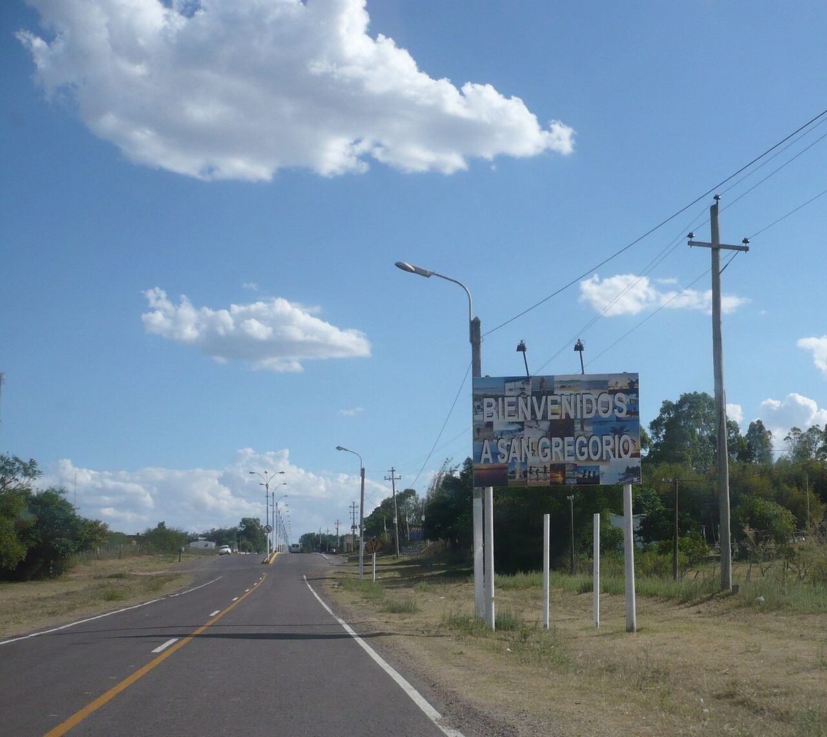
Picture a small town of around 2,500 people on the shore of Lago Rincón del Bonete — Uruguay’s largest reservoir, formed when the Rincón del Bonete dam flooded the Río Negro valley in 1945 — where every wall, every corner, every fence panel has been painted by a different artist. That is San Gregorio de Polanco, in Tacuarembó department, four hours north of Montevideo on sealed roads. The festival that started the murals, El Pueblo que se Pinta, has been running for decades; artists arrive each summer, claim a wall and get to work. The result is an open-air gallery of perhaps 200 murals — folkloric gauchos next to abstract color explosions next to portraits of local schoolchildren — that just happens to be attached to a lakeside town with fishing boats and a beach.
The lake is genuinely beautiful: long, still, surrounded by grassland, with none of the resort infrastructure that accumulates around water in better-known places. Swim off the town beach, rent a pedalo, eat a parrillada with a view of the water. The honest caveat: accommodation is very limited and the town quietens dramatically outside summer, so call ahead if you visit between April and November. Most visitors use their Uruguay trip to stick to the coast; this is the argument for going north instead. To get there, take Route 5 north past Tacuarembó then Route 26 west — the last section is a short ripio stretch but manageable in any car.
Valle del Lunarejo: sub-tropical canyon in the far north
Rivera department, bumping against the Brazilian border, is gaucho country with an unexpected secret: a protected valley that feels more like Misiones province than anything you’d expect from Uruguay’s rolling plains. Valle del Lunarejo is a deep quebrada (ravine) carved by the Lunarejo river through the Cuchilla de Haedo hills, dense with subtropical gallery forest, waterfalls, bromeliads and bird species — approaching harpy-eagle territory for rarity — that are at the southern limit of their range. The area is a declared Regional Natural Park and biological corridor; howler monkeys occasionally make it down from the Brazilian side.
The main lodge and trailhead is at Estancia La Aurora, which runs guided hikes and horseback rides through the valley. Trails are not heavily marked — this is not a managed national park with information boards and a cafe — so going with a guide or staying at the estancia makes navigational sense. The access road from Route 30 involves serious ripio, so a high-clearance vehicle is worth booking. For more on Uruguay’s protected wild areas, the national parks guide covers the full picture. The honest caveat: it takes real commitment to get here, and the infrastructure is basic. That is also the reason it feels like a genuine discovery rather than a managed experience.
Quebrada de los Cuervos: the canyon that started it all

In 1977, Uruguay designated its first protected landscape at Quebrada de los Cuervos — the Ravens’ Gorge — in Treinta y Tres department, four hours east of Montevideo. The name comes from the black vultures (cuervos) that circle the canyon walls, though the site is richer than its ominous branding suggests. Down in the gorge, the Yerbal Chico river cuts through basalt, feeding gallery forest of myrtles, tree ferns and orchids that feel tropical and improbable against the surrounding cattle plains. Small waterfalls feed natural pools for swimming, and a self-guided trail of around two hours takes you through the best of it.
The protected area sits roughly 35 kilometers from the town of Treinta y Tres, with the final section unpaved. Camping is allowed within the park and costs almost nothing; a basic visitor center operates at the entrance. What makes this place arresting is the contrast — you drive through flat open country for hours, then the road dips into a hidden world of cliff faces and birdsong. Black and white monjita birds, ringed kingfishers and the occasional cavy use the creek as their high street. The practical caveat: facilities are very simple. Bring your own food, carry enough water for the full hike, and confirm the access track is dry before going in wet season. The national parks page has updated access information for all protected areas.
Cerro Arequita, Villa Serrana and Salto del Penitente: Lavalleja’s hill circuit
Lavalleja department, two hours from Montevideo on Route 8, is where the capital’s residents go when they need hills. The department centers on Minas — a colonial market town famous for its mineral water and its pilgrimage church on Cerro Verdún — but the more interesting terrain lies outside it. Cerro Arequita is a granite outcrop riddled with caves, including the Gruta de los Murciélagos (Bat Cave), where thousands of bats roost in a cavern large enough to walk into. At dusk they emerge in a spiraling column that takes fifteen minutes to thin. It is one of the stranger spectacles in Uruguay and costs almost nothing to witness.

Twenty minutes on, Villa Serrana is a tiny pine-forest retreat of perhaps 40 houses designed by architect Julio Vilamajó in the 1940s as a hill escape. It never quite became what he imagined, which is partly why it works: a handful of posadas (guesthouses), forest walks, and granite boulders to scramble. Nearby Salto del Penitente is Uruguay’s tallest waterfall — around 60 meters over several drops — accessed via a thirty-minute riverside walk from a small car park. In winter the gorge runs full; in summer the upper pools are swimmable. The caveat: all three suit a circuit rather than a standalone trip, so link Cerro Arequita, Villa Serrana and the waterfall in a single day, or two nights if you stay at a posada. The estancia guide lists several Lavalleja properties as a base.
Tacuarembó: the genuine gaucho capital
Every country has a region that keeps its identity stubbornly intact regardless of tourism trends. In Uruguay, that place is Tacuarembó. The northern department is the cultural heartland of the gaucho — the cattle-herding horseman who shaped the country’s character — and takes this seriously year-round. The provincial capital is a quiet city of 50,000 with tree-lined streets, a good market, and a museum dedicated to Carlos Gardel, the tango legend whom Tacuarembó claims as a native son. Buenos Aires contests this vigorously; Tacuarembó is not impressed by the argument and shows no sign of revising its position.
In early March, the Fiesta de la Patria Gaucha transforms the town for five days: horsemanship competitions, jineteadas (bronco-riding that makes rodeo look cushioned), open-fire cooking competitions, folk music, and thousands of people in traditional dress arriving from across the region. Foreign tourists are almost absent. That is not a warning; it is the point. Laguna de las Lavanderas — a nearby wetland with flamingos and over 200 recorded bird species — is worth a half-day. Getting there is straightforward: direct buses from Tres Cruces terminal in Montevideo take four hours on comfortable long-distance coaches, and the town itself has adequate mid-range accommodation.
A remote estancia stay: gaucho life from the inside
No survey of under-visited Uruguay would be complete without the overnight estancia. These working cattle ranches — some running 10,000+ hectares with family histories stretching back two centuries — take guests not as a tourism gimmick but as a second income that helps pay for the land. The experience varies by property: some are grand historic houses with libraries and chapels; others are working farms where you share dinner with the family. What they have in common is this: a morning on horseback across open country with no fences on the horizon, lunch from the asado fire, and an evening so quiet you hear the cattle breathing.
Estancia stays across the interior run from around US$150 per person per night including meals and activities; some offer day visits for less. Properties cluster around Cerro Colorado (two hours from Montevideo), the Lavalleja hills, and the Tacuarembó north. The caveat is access — rural properties may require your own vehicle or a pre-arranged transfer — but the logistics are almost always worth the effort. This is also, frankly, the single best antidote to the January coastal crowds: everyone is on the beach while you have the grassland to yourself.
Fray Bentos: the meat factory that fed two world wars

The town of Fray Bentos, on the Río Uruguay in Río Negro department, gave its name to the British brand of canned corned beef for the same reason that Champagne gave its name to sparkling wine: it was the place that made the thing first and best. From 1863 the Liebig Extract of Meat Company — later the Anglo Meat Packing Plant — processed cattle from the surrounding plains into meat extract, corned beef and bouillon shipped to every corner of the British Empire. OXO cubes exist because of this factory. At its height the plant employed workers from 60 countries and provisioned both World Wars; German submarines specifically targeted ships carrying its cargo.
In 2015 UNESCO listed the entire industrial complex as a World Heritage Site — one of very few industrial heritage sites in the Americas to achieve that designation. The guided tour through the echoing machine rooms, cold-storage chambers, the workers’ town that grew up around the plant, and the river-dock infrastructure takes around 90 minutes and is one of the most unexpectedly gripping things you can do in Uruguay. Entry costs around UYU 150 (roughly US$3–4 at current rates), with free entry on Tuesdays when last checked; some days offer English-language tours — call ahead to confirm. The honest caveat: Fray Bentos is a 4.5-hour drive or comfortable overnight bus from Montevideo, so pair it with a visit to the termas or Paysandú to the north, building a full northwest circuit that most international visitors never attempt.
Artigas amethyst country: the gemstone safari
In October 2024, Uruguay officially declared amethyst its national stone — a decision that requires no committee to understand once you have seen what comes out of the ground near Artigas, the remote northern city near the Brazilian border. The basalt of this region holds some of the world’s finest amethyst geodes: deep violet crystals inside stone cavities, some the size of bathtubs, formed around 130 million years ago when volcanic magma cooled and groundwater crystallized. Uruguay’s amethyst commands premium prices among collectors globally — the color and crystal quality are considered by the trade to be essentially unmatched.
The practical entry point for visitors is the Safari Minero, a tour operation that takes small groups into active mining areas to see extraction in progress, walk through processing facilities, and choose rough and polished stones at source prices. Book ahead because group sizes are limited. Getting to Artigas — a six-hour bus journey north from Montevideo — is the main commitment; fly if budget allows, as the domestic route exists. The caveat: this is not a day trip from anywhere else on this list. Build it as a destination in its own right, perhaps combined with a border excursion into Rivera or Brazilian Quaraí. The experience of watching a geode the size of a bathtub get levered out of the earth is one the Uruguayan north doesn’t advertise loudly enough — but it absolutely should.
The wild and secondary coast: beyond the famous trio
Uruguay’s coastline runs 660 kilometers from the Río de la Plata to the Brazilian border. Punta del Este and Cabo Polonio get the coverage; between and around them are dozens of balnearios (beach resorts), lagoons, and coastal hamlets that barely appear on tourist maps. Rocha department alone holds more empty beach than most countries manage in their entirety. What follows is the part of that coast — covered in depth by the Rocha guide — that rewards those willing to travel past the last well-known name on the map.
Barra de Valizas and Aguas Dulces: dune-backed boho hamlets

The Route 10 coastal road in Rocha passes through a string of small settlements that could not be more different from the polished beach clubs of the south. Barra de Valizas is where the Valizas river meets the sea — a village of sand streets, artisan stalls, candlelit restaurants and maybe 300 permanent residents. There is no ATM in the village proper, card machines are unreliable, and the occasional power cut is part of the local weather. Aguas Dulces, twenty minutes north on a partly unsealed track, is even smaller: a scatter of brightly painted houses where fishermen haul nets alongside surfers, and where “infrastructure” means a couple of almacenes (corner stores) and a summer parrilla that might be open by noon.
Both villages suit travelers who find stripped-back genuinely appealing rather than performatively rustic. Come off-season — April to November — and you will have the dunes to yourself. In January the villages fill with a young Uruguayan crowd who know precisely what they have found. Bring cash, power banks, and lower your expectations of connectivity so you can raise them of everything else. For the wider coastal sequence — La Paloma, La Pedrera, Punta del Diablo and the protected parks — the best beaches guide lays out the full Rocha coast.
The Valizas–Cabo Polonio dune walk: the best coastal hike in Uruguay
The eight-kilometer walk from Barra de Valizas across the dune field to Cabo Polonio is the finest piece of coastal walking in Uruguay and gets a fraction of the attention it deserves. You start by crossing the Valizas river mouth — a flat-bottomed rowboat carries you over in season for small change — and then the dunes begin. These are not the tame, low dunes of most Atlantic beach towns. The Valizas–Polonio field rises to 40 meters and more, forming a genuine sand landscape with its own microclimate, no shade, no paths and no signs. On the crest of Cerro de la Buena Vista you see ocean on one side and the dark water of Laguna de Castillos on the other, and the only sounds are wind and your own breathing.
Allow three to four hours at a steady pace, carry two liters of water minimum per person — there is nothing between start and finish — and wear shoes you do not mind filling with sand. Time arrival in Cabo Polonio for lunch; the 4×4 trucks shuttling back to Route 10 will carry you out. At full moon in summer, locals walk it by moonlight — which tells you everything about the atmosphere this landscape generates. The caveat: in midsummer heat (January) start at dawn or not at all. Attempting the crossing midday at 35°C is genuinely punishing. Every other month, start whenever you like and enjoy it thoroughly.
Laguna de Rocha and Cabo Santa María: the birdwatcher’s secret
South of La Paloma, Laguna de Rocha is a brackish coastal lagoon of around 7,000 hectares protected as part of Uruguay’s Sistema de Áreas Protegidas. What makes it ecologically distinctive is the water exchange: a seasonal sand bar separates the lagoon from the Atlantic for most of the year, and local fishing communities manage when to open it — controlling salinity and fish stocks in a tradition that predates Uruguayan independence. The result is a lagoon of exceptional richness: over 200 recorded bird species, including roseate spoonbills, several heron species, coscoroba swans and — in season — Chilean flamingos feeding in the shallows.
Access is via a ripio road south of La Paloma; a small visitor center operates near the lagoon edge, and kayaks can be rented from local operators in town. Early morning on the water in winter — warm clothes, thermos of mate, complete quiet — is the kind of experience that justifies an entire Uruguay trip on its own terms. The caveat: birdwatching infrastructure here is self-organized. There are no hides or guided walks as standard; contact La Paloma-based operators ahead of time if you want a guide with local knowledge. Without one you will still see extraordinary things. Check what is currently accessible with the Rocha guide before traveling.
Cristo Obrero church, Atlántida: UNESCO on the Costa de Oro

The Costa de Oro — the “golden coast” of Canelones between Montevideo and the east — is where ordinary Uruguayan families summer: modest beach towns, pine forests, cheap rentals, no pretension. Atlántida is its hub, and 45 minutes from the capital on the inland road stands a building that engineers travel from Europe to study. Eladio Dieste’s Cristo Obrero church, completed in 1960 and named a UNESCO World Heritage Site in 2021, has walls of self-supporting undulating brick — Gaussian vaults in engineering terms — that curve upward with no internal columns, letting natural light fall through narrow slot windows in ways that shift by the hour. Dieste was an engineer rather than an architect. He worked out how to make brick do what nobody believed brick could do, and built it for a working-class congregation in a suburb nobody had heard of.
The church is still an active parish. Walk in for free during opening hours, sit in the pews and look up, and understand why it appears in architecture textbooks alongside buildings that cost a hundred times more to construct. It seats perhaps 150 people in a space 22 meters long — intimate in scale, enormous in achievement. The honest caveat: opening hours vary and the church may be closed for services or cleaning. Since it is 45 minutes from Montevideo and the surrounding town is pleasant for a swim and lunch, there is no real risk of a wasted trip regardless. The Montevideo guide covers the broader Canelones coastal strip in context.
Quirky one-offs: the places that defy easy categories
Some places resist the usual headings. They are not wilderness reserves or beach towns or gaucho heartlands. They are just themselves — specific, slightly unexpected, and worth the detour.
Paysandú: the northwest river city nobody visits
Paysandú, on the Río Uruguay facing Argentina, is Uruguay’s third city by population and its most consistently overlooked. The riverside rambla here is long, calm and planted with palms; the Basílica de Nuestra Señora del Rosario is one of the finer colonial churches in the country; and during carnival the local murgas perform with a passion suggesting Paysandú has decided not to compete with Montevideo on carnival but simply to outdo it in quality per capita. January brings the Semana de la Cerveza — a beer festival that has been running for decades and attracts Argentines by the boatload from Colón across the river.
The bus from Montevideo takes around five hours on comfortable long-distance coaches, and Paysandú sits naturally on the route between Montevideo and the hot springs zone around Salto. Combine the two for a genuinely satisfying northwest circuit that most international itineraries ignore entirely. The caveat: Paysandú is a real working city, not a tourist town, and the experience is accordingly unscripted. That is the recommendation rather than the warning. A city that has not arranged itself around visitors is a city you can actually visit on its own terms.
Mercedes and the Río Negro wetlands: birds and slow water
An hour south of Fray Bentos, the city of Mercedes sits at the confluence of the Río Negro and wetland systems forming some of the most bird-rich habitat in western Uruguay. The town itself is pleasant enough — colonial grid, cathedral square, a beach on the river that fills with families in summer — but the reason to come is the delta around Isla Queguay. Jabiru storks, giant otters, caiman and a variety of wading birds have chosen this corner of Soriano department as preferred real estate. Local operators run boat tours through the delta channels; several estancias in the surrounding countryside offer accommodation with birdwatching guides included in the rate.
Mercedes is three hours from Montevideo by bus on Route 2 — easily done as an overnight, or combined with Fray Bentos and Carmelo wine country for a full western circuit that almost no foreign visitor attempts. Check the estancia directory for Soriano properties. The caveat: birdwatching here rewards patience and early starts. Arrive, check in, and expect the highlights from the plaza by lunchtime, and you will be disappointed. Bring binoculars, arrange a boat tour in advance, and give it a full morning on the water — the delta repays the effort generously.
Uruguay under-visited destinations: your questions answered
What are the most overlooked places in Uruguay?
The interior departments — Tacuarembó, Rivera, Treinta y Tres, Lavalleja — are systematically skipped by visitors who stick to the coastal corridor. Within that interior, San Gregorio de Polanco, Valle del Lunarejo and Quebrada de los Cuervos are the most genuinely under-visited destinations with strong visitor payoff. On the coast, Barra de Valizas and Aguas Dulces sit in the gap between Cabo Polonio and La Paloma that most itineraries skip entirely, despite holding some of the finest dune landscape in the country.
Is Uruguay off the beaten path as a destination?
Compared to Argentina and Brazil, yes — Uruguay receives far fewer international visitors proportionally, and even busy places rarely feel crowded outside January. Beyond the Punta del Este–Colonia–Montevideo triangle, the country becomes genuinely off the beaten path within about an hour’s drive in almost any direction. A rental car and two weeks lets you explore places where you routinely go a full day without seeing another foreign tourist, particularly across the north and west. The best places to visit overview provides a broader framework for planning.
What unusual things can you do in Uruguay that you can’t do elsewhere?
Several experiences on this list are effectively unique. Walk eight kilometers across an unmanned dune field between two car-free beach villages — Valizas to Cabo Polonio — with nothing but ocean, lagoon and sand on the horizon. Take a UNESCO-certified tour of a 19th-century meat factory that provisioned both World Wars and helped invent the OXO cube (Fray Bentos). Visit an active amethyst mine where Uruguay’s national stone is extracted from 130-million-year-old basalt geodes (Artigas). Sit inside a self-supporting undulating brick church that most architects believed was physically impossible to construct — now a UNESCO World Heritage Site (Cristo Obrero, Atlántida). These are unusual things to do in Uruguay that no other country offers in combination.
How do you get around Uruguay independently?
Uruguay’s long-distance bus network — COT, Rutas del Sol, Onda and CITA among the main carriers — is comfortable, cheap and reaches every town in this guide from Montevideo’s Tres Cruces terminal. For the interior and secondary coast, a rental car is the most liberating option: roads are quiet, tolls are manageable at tollbooths, and fuel stations are frequent. The zero-alcohol driving limit is enforced throughout Uruguay, which is worth noting. Budget for ripio on approaches to parks and rural properties. The getting to Uruguay guide covers arrivals in detail; domestic travel is straightforward once you are in the country.
Are these under-visited places safe for independent travelers?
Yes. The interior and secondary coast are consistently among the safest areas in Uruguay — which is itself one of the most stable and safe countries in South America. The risks are practical rather than security-related: confirm access roads are passable after heavy rain, check accommodation is open before driving two hours to reach it, carry cash to villages without ATMs, and bring more water than you think you need on any hike. Solo travelers and LGBTQ+ visitors generally report feeling comfortable throughout the country, including in rural areas and small towns. The is Uruguay worth visiting page addresses safety and practicalities in more detail.
What is the best time to visit Uruguay’s lesser-known places?
March and November hit the sweet spot for almost everything on this list: summer temperatures without January’s coastal crowds, estancias with more space, the dune walk cool enough to attempt after 7am, and accommodation prices that drop meaningfully from the peak. For hot springs and interior towns, July through September works well — mild rather than cold, and the thermal pools feel exactly right. Birdwatching at Laguna de Rocha and the Río Negro wetlands peaks in winter when migrant species augment the resident population. The Patria Gaucha festival in Tacuarembó runs in early March; the Artigas mines operate year-round.
Final thoughts
The three famous places — Punta del Este, Colonia, Montevideo — are famous for reasons. They are good. Go. But the places on this list are where Uruguay stops being a destination and starts being a country, which is a different thing entirely. San Gregorio de Polanco doesn’t know you’re coming; Fray Bentos doesn’t perform; the dunes between Valizas and Cabo Polonio don’t care about your timeline. That indifference is the gift. Turn up, slow down, bring cash and a thermos, and follow the ripio until it ends somewhere worth being. Uruguay rewards that consistently and without fanfare — which is, perhaps, the most Uruguayan thing about it.
Ready to plan the full trip? The complete Uruguay things-to-do guide covers the icons alongside these under-visited corners, so you can build an itinerary that hits the classics and then goes properly sideways into the good stuff.
Credits & sources
Sources & further reading
- Uruguay Ministry of Tourism — official destination, park and event information
- UNESCO: Fray Bentos Industrial Landscape — World Heritage listing and documentation
- Guruguay: Cristo Obrero UNESCO listing — background on Dieste’s church and its World Heritage status
- International Colored Gemstone Association: Artigas amethyst — gemological significance of the Artigas region
Photo credits
All images via Wikimedia Commons: San Gregorio De Polanco Murals by Carohv91 (CC BY-SA 4.0); Quebrada De Los Cuervos Canyon by Caritocabrera (CC BY-SA 3.0); Villa Serrana Lavalleja Hills by Luis Irigoyen (CC BY 3.0); Fray Bentos Frigorifico Museum by Mx. Granger (CC0); Valizas Dunes Rocha Uruguay by Casaseneleste (CC BY-SA 4.0); Cristo Obrero Church Atlantida by Andrés Franchi Ugart… (CC BY-SA 3.0).