Quebrada de los Cuervos: Uruguay’s Hidden Canyon (2026)
The first thing I noticed at the rim was the silence, and then the birds breaking it. I had walked out to the mirador expecting a view, and got something stranger: a slow wheel of black-winged birds riding the warm air below me. Vultures, dozens of them, tilting on thermals that rose off the canyon floor and dropping out of sight into the green. I stood there longer than I meant to.
That is the moment people come for. The quebrada de los cuervos is a deep, forested ravine in the Treinta y Tres department of eastern Uruguay — a quebrada (ravine or canyon) cut by the Arroyo Yerbal Chico, an arroyo (stream), and the country’s first protected natural area. The “cuervos” are not crows at all.
Those two facts shape everything: this place is genuinely remote, the road turns to gravel, and the birds you came to see ride the thermals below your feet. This page is about getting you there and into the canyon properly.
I am writing this for travelers who want the real version: trail mechanics, what the drive is actually like on the gravel, what it costs, when to go, and where to sleep if a day trip will not do. If you want a broad walking overview of the country instead, I keep a separate guide to hiking in Uruguay for that. This one stays in the canyon.
| Detail | Info |
|---|---|
| Location | Paisaje Protegido Quebrada de los Cuervos, Sierras del Yerbal |
| Department | Treinta y Tres, eastern Uruguay |
| From Montevideo | ~290 km / about 4 hours via Ruta 8 |
| From Treinta y Tres town | ~40 km (roughly 45 min, last stretch on gravel) |
| Main trail | Canyon loop, ~3.5 km, about 2 hours with stops |
| Difficulty | Moderate — steep, rocky descent and climb (rope handrails) |
| Open | Wednesday to Sunday, roughly 8am to 5pm |
| Fee | Small per-person fee (around a few US dollars; pay at the gate) |
| Best season | Autumn (Mar–May) and spring (Sep–Nov) |
What the Quebrada de los Cuervos actually is
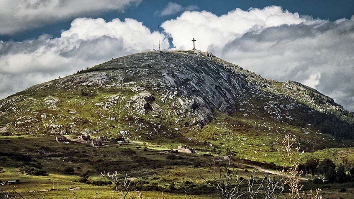
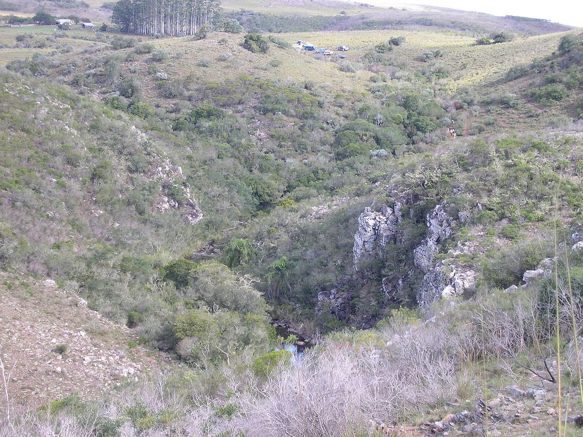
Picture eastern Uruguay and you probably picture flatness — cattle, long grass, a sky that goes on too far. The quebrada breaks that. Here the land folds. The Arroyo Yerbal Chico has carved a steep-sided valley into the Sierras del Yerbal, and in places the canyon walls drop more than a hundred meters from rim to stream. From the top it looks less like Uruguay and more like a slab of southern Brazil that wandered across the border and stayed.
Down in that fold, where the sun reaches late and the air stays humid, grows something special: a relict of subtropical forest. Botanists treat the quebrada as an ecological corridor — a green thread linking the woodland of eastern Uruguay to warmer, more tropical systems further north. One 1990s survey logged around 100 bird species here, plus mammals, amphibians, fish, and roughly 87 of Uruguay’s native tree species along with a couple of dozen ferns. For a country not known for dramatic terrain, that is a remarkable density of life packed into one ravine.
The “first protected landscape” status
This is the detail most guides skip, and it matters. The Quebrada de los Cuervos was declared a protected natural area on 21 August 1986 — the first in Uruguay. Before this place, the country had no formal protected area at all. Since 2008 it has been folded into the national protected-areas system (the SNAP), and its full official name now stretches to “Paisaje Protegido Quebrada de los Cuervos y Sierras del Yerbal,” covering not just the canyon but the surrounding hill country and grassland.
What that means for you on the ground: there is a gate, there is an attendant, you sign in, you pay a modest fee, and the trails are managed rather than wild-and-anything-goes. It also means the swimming holes you will see at the bottom are off-limits inside the official park — conservation first. That can sting on a hot day. I will come back to the workaround.
The hiking trails: descent, river, and the long way back
Here is the part the thin listicles get vague about, so let me be concrete. From the visitor area you either drive or walk a short distance to the trailhead. At the trailhead you will find a sign pointing two ways — because the main route is a loop, and you can take it clockwise or counter-clockwise. Either direction brings you back to the same spot.
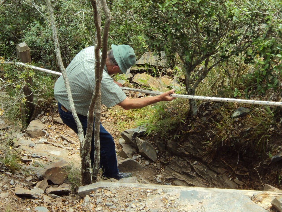
The loop runs somewhere around 3 to 3.5 kilometers and takes most people about two hours once you factor in stopping for birds, photos and breath. Do not let the modest distance fool you. This is not a flat stroll. The trail starts in dry, open grassland on the canyon rim, then plunges down into the gorge through forest and rock. The descent is steep and genuinely rocky, and in the trickier sections the park has fixed rope handrails and built steps to get you down to the stream.
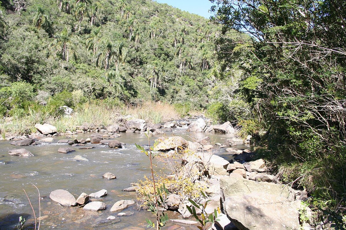
At the bottom you reach the Arroyo Yerbal Chico — clear water, shade, a real change in temperature. You cross, climb up the far side, walk a stretch along the ridge, then drop back down to the water a second time before the final climb back out toward the mirador. One hiker I read described it well: down through forest on ropes, across the river, up and along the ridge, back down to cool off, then the climb to the viewpoint and a half-kilometer back to the car. That is the shape of it.
The mirador and the easy option
Not everyone wants the full scramble, and you do not have to do it. There is a separate, short, easy walk straight to the mirador — the lookout perched on the canyon edge — which gives you the sweeping view of the gorge, the river far below, and, if the timing is right, those vultures wheeling under your feet. If you are travelling with kids, with someone less mobile, or you simply arrive late, do the mirador and call it a good day.
How hard is it, really
Moderate is the honest label. The footing is uneven and can be slick after rain, and the climbs out of the canyon will get your heart going. But it is well marked, the rope handrails are reassuring, and the effort is well within reach for anyone reasonably fit. I came across one review from a woman who did the descent two weeks after breaking her collarbone and managed fine. Sturdy shoes, not sandals. Take it slowly on the steps.
The honest drawback: the official trail network is small. You are looking at one main loop plus the mirador walk, not a multi-day backcountry system. If you are an experienced long-distance hiker craving variety and big-mountain mileage, the quebrada is a half-day, not an expedition. What it lacks in length it makes up for in concentration — but go in knowing the scale.
Wildlife, vultures, and the serrana forest
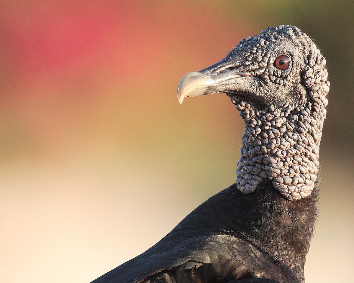
Let me clear up the name, because nearly every English source online gets it wrong. “Cuervo” translates to “crow,” so the place gets called Crows Ravine, and writers picture black corvids. They are wrong. The “cuervos” here are cuervo in the local sense — the New World vultures that breed and roost on these cliffs. You will mostly see the turkey vulture (locally the red-headed jote, Cathartes aura) and the black vulture (Coragyps atratus), with the yellow-headed vulture turning up too.
That correction is not pedantry. It changes what you watch for. These are big soaring birds, and the canyon is a thermal machine — warm air rising off the rock and forest gives them a free elevator. Stand at the mirador mid-morning and you will see them spiral up out of the gorge, which is exactly why the lookout is the best seat in the place. The vultures are the show.
They are not the only birds. The quebrada is recognised as an Important Bird Area, with several threatened grassland and marsh species in the wider protected landscape. On the access roads — especially the gravel of Ruta 98 — people regularly spot rheas (the big flightless ñandú), southern screamers, ducks and waterfowl. Down in the canyon I have read accounts of toucans and a steady chorus of woodland birds. Bring binoculars; if birds are your thing, this is one of the better stops in the country, and it pairs naturally with my notes on birdwatching in Uruguay and the wider Uruguay wildlife picture.
Then there is the forest itself — monte serrano or serrana, the native hill forest that clings to the canyon’s flanks. It is humid and green and ferny in a way the surrounding grassland is not, a gallery of trees following the stream. Underfoot you might spot a mulita (a small armadillo), lizards, frogs; deer move through the woodland. It feels, genuinely, like a different climate from the dry rim two hundred meters above. That contrast — grassland top, subtropical bottom — is the quiet thrill of the whole walk.
Getting there: Ruta 8, the gravel, and the gate
Remote is the word, and you should respect it. The quebrada sits roughly 40 km from the town of Treinta y Tres and about 290 km from Montevideo. From the capital it is a four-hour drive northeast on Ruta 8 — a good paved highway most of the way. The wrinkle is the last stretch.
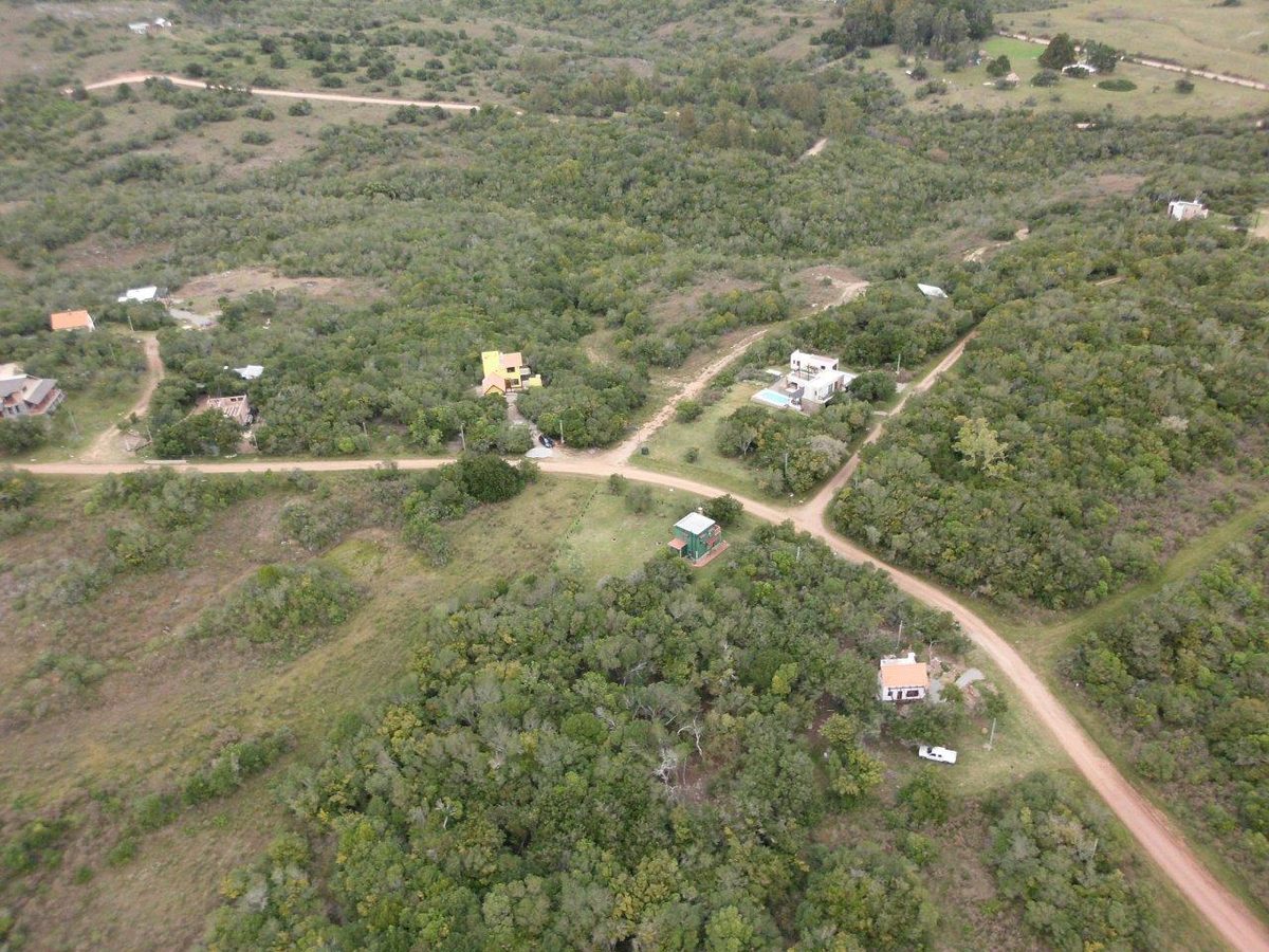
Coming up Ruta 8, you watch for the signed turnoff to Quebrada de los Cuervos, roughly around the kilometer-306 mark. There you leave the asphalt and turn onto ripio (gravel/dirt road), following it west toward the park for somewhere around 20 to 24 kilometers. The signs point the way. This gravel is the real arrival: washboard in places, dusty, slow. A regular two-wheel-drive car handles it fine — plenty of people do it in an ordinary rental — but you drive it at gravel speed, not highway speed, and you accept a film of dust on everything.
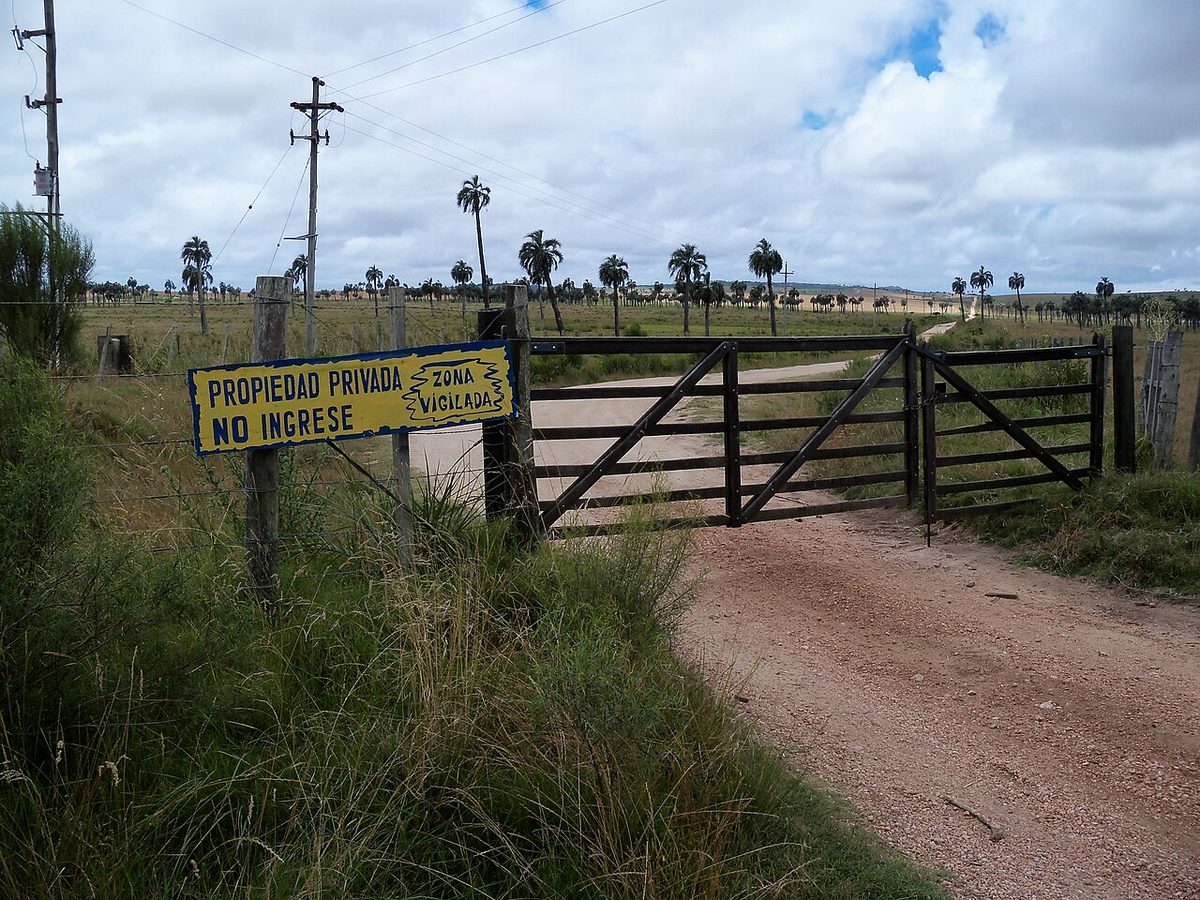
There is a second way in, on the gravel of Ruta 98, which some travelers use as a scenic loop — go in one road, out the other. One reviewer captured the choice perfectly: there is a well-kept dirt road that gets you there in about 40 minutes, and there is a rougher, washboarded “gaucho road” past grazing cattle and rheas. If you have the time and a car that can take it, the rough one is more fun. If you do not, take the smooth one.
Can you get there without a car?
Barely, and not comfortably. Long-distance buses from Montevideo toward Treinta y Tres or Melo run up Ruta 8 and can drop you at the turnoff — but there is no public transport from that turnoff to the park gate, and that is a 20-plus kilometer gravel road. You would be hitchhiking or facing a very long walk. Realistically, you need a car, a rental from Treinta y Tres, or a tour/taxi arrangement from town. This is the honest drawback of the whole place: it rewards self-drive and punishes those without wheels.
The visitor centre and gate
When you arrive there is an administration house near the entrance with an attendant on duty. You sign the register, pay the fee, and they open the gate so you can drive the last kilometer or so to the parking area. There is a basic information point, restrooms, and a map of the trail and its stops (paradas) on the desk — photograph that map before you set off. Crucially, the park is only open Wednesday through Sunday, so do not show up on a Monday and find a locked gate. And the hours mean an 8am earliest start, which, fair warning, is past the best dawn window for shy wildlife.
Treinta y Tres and the Río Olimar as a base
You will almost certainly stage out of Treinta y Tres, the departmental capital about 40 km away and the nearest place with real services — fuel, a supermarket, hotels, restaurants. It is a working interior town, not a tourist resort, and that is part of its charm. Stock up here, because once you turn onto the gravel there is nothing.
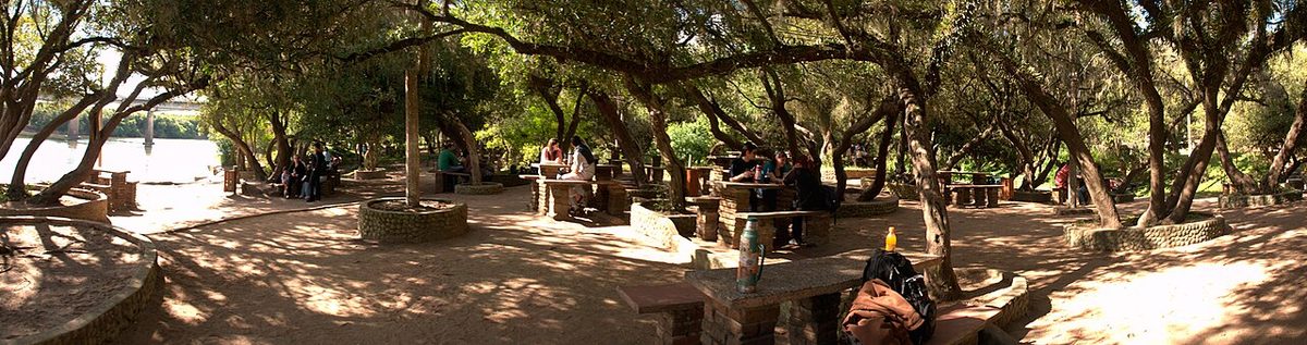
What makes the town more than a fuel stop is the Río Olimar, the wide, calm river that runs past it. Locals are proud of it — it has its own folklore and its own festival — and the riverbanks and beaches are a genuinely pleasant place to decompress after a dusty day in the canyon. A swim in the Olimar, an evening walk along the water, an asado: that is the right way to close out a quebrada day. The town also sits within easy reach of the broader eastern interior, so it slots neatly into a longer Uruguay road trip if you are stitching one together.
Where to stay and camp
You have three broad choices, and they trade comfort against proximity.
Camp at the park. There is a campsite and a leisure/picnic area near the park entrance — bring your own gear, because there is no equipment hire. Waking up inside the protected landscape, with the dawn chorus and the chance to be at the mirador early, is the purist’s option. It is also the most basic; set your expectations to “rustic,” not “glamping.”
Stay nearby, in the country. Within a short drive there are rural lodgings and a couple of estancias — working ranches that take guests. Riding to the canyon on horseback from a nearby estancia is a thing people genuinely do, and it is a wonderful slow way to arrive. If a stay on the land appeals, my notes on the estancia experience in Uruguay cover how that works.
Sleep in Treinta y Tres. The simplest plan. Base in town where the beds, food and fuel are, then day-trip to the canyon. It means more driving on the day, but you sleep comfortably and you are not committed to the park’s limited services. For the wider lodging picture across the country, see where to stay in Uruguay.
One more option worth knowing, and it is the workaround I promised. Adjacent to the official park there is private land — a separate property with its own access — where, for a small fee (I have seen 30 pesos quoted), you can walk to a waterfall and actually swim in the pools, which the official park forbids. Some travelers add a home-cooked meal at the family’s house afterward. That private section keeps different hours from the Wed–Sun park, so it is a useful card to have.
When to go
Autumn and spring are the sweet spots. Aim for March to May or September to November, when daytime temperatures sit in a comfortable 15–25°C range, the light is kind, and the forest is at its best. Spring brings wildflowers and peak bird activity; autumn brings stable, mild, walking-perfect days and thinner crowds.
Summer (December to February) is doable but bring respect for the heat. One reviewer described doing the loop at 28°C with no shade and no water source for two and a half hours and called it closer to torture than tourism — a useful warning. If you go in high summer, start as early as the 8am opening allows, carry far more water than you think you need (there is no reliable drinking water on the trail itself), and be honest about your tolerance. Winter is quieter and cooler, with shorter days and a real chance of mud on the descent; the canyon can be atmospheric in the cold, but plan for slick footing.
Timing fits into the bigger seasonal calendar too — if you are still shaping your trip, my breakdown of the best time to visit Uruguay puts the canyon’s seasons in national context.
How to actually visit: a day plan and an overnight plan
Two realistic shapes for a trip, depending on your time.
The day trip (from Treinta y Tres). Leave town early. Drive the ~40 km, with the last stretch on gravel, and aim to be at the gate not long after it opens at 8am to beat both heat and crowds. Sign in, pay, drive to the parking area, photograph the trail map. Do the full loop — budget two to two-and-a-half hours with stops — then take the short walk to the mirador for the vulture show if you have not already. Eat the lunch you packed (there is no food for sale), drive back, and reward yourself with the Río Olimar in the afternoon. That is a full, satisfying day.
An overnight (canyon-first). Camp at the park or stay at a nearby estancia. Get to the mirador early when the light is low and the air is still cool, walk the loop before the day heats up, and spend the rest of the day slowly — birds, the stream, the private waterfall next door for a swim. This is the version for people who want to feel the place rather than tick it. It pairs beautifully with a wider loop through eastern Uruguay; the canyon is a natural inland counterpoint to the coast, and it sits comfortably alongside the bigger picture of Uruguay’s national parks and protected areas, which is where I would point you to plan the rest.
Whichever you choose, three rules: carry your own water and food, do not count on phone signal, and check before you travel that the day you want is a Wednesday-through-Sunday and that the park is open — small interior parks change their hours.
Quebrada de los Cuervos: your questions answered
Where is the Quebrada de los Cuervos?
It is in the Treinta y Tres department of eastern Uruguay, carved into the Sierras del Yerbal by the Arroyo Yerbal Chico. The protected landscape sits roughly 40 km from the town of Treinta y Tres and about 290 km — around four hours by road on Ruta 8 — northeast of Montevideo. The last stretch to the gate is gravel.
Are the “cuervos” really crows?
No. Despite the name translating to “Crows Ravine,” the cuervos are New World vultures, not crows. You will mostly see turkey vultures (the red-headed jote) and black vultures soaring on thermals that rise out of the canyon. Watching them circle below you from the mirador is the signature experience of the place.
How long and how hard is the main hike?
The main trail is a loop of roughly 3 to 3.5 km that takes about two hours with stops. It is rated moderate: a steep, rocky descent into the gorge and back out, with fixed rope handrails on the tricky sections. It is well marked and manageable for reasonably fit walkers, but it is not a flat stroll — wear sturdy shoes.
Do I need a car to visit?
Effectively, yes. Buses on Ruta 8 can drop you at the turnoff, but there is no public transport for the 20-plus kilometers of gravel road to the gate. Most visitors self-drive (a normal car handles the ripio slowly) or arrange a taxi or tour from Treinta y Tres. This remoteness is the trip’s main catch.
When is the park open and what does it cost?
The official park is open Wednesday to Sunday, roughly 8am to 5pm — not Mondays or Tuesdays. You pay a small per-person fee at the gate (a few US dollars, last I checked) and sign the register. A separate private property next door charges its own small fee for a waterfall walk where, unlike the official park, you are allowed to swim.
What’s the best time of year to go?
Autumn (March–May) and spring (September–November) are ideal — mild 15–25°C days, good light, active birdlife and fewer people. Summer works if you start early and carry plenty of water, since there is no shade on parts of the loop and no reliable drinking water on the trail. Winter is cool, quiet, and can be muddy underfoot.
Final thoughts
Most visitors to Uruguay never make it here, and I understand why — it is far, the road turns to gravel, and the country’s beaches and Montevideo pull harder. But the quebrada is the place I send people who tell me Uruguay is flat and they have seen it all. They have not seen this: a hundred-meter ravine of subtropical forest, a stream you can hear before you see it, and a sky full of vultures riding the heat off the rock.
Go with a car, go on a Wednesday-through-Sunday, go in autumn or spring, and carry your own water. Do the loop, then sit at the mirador and watch the birds work the thermals. It is a small protected area with a big claim — Uruguay’s first — and it earns it. Treat it as a half-day of effort that pays back something you will not find anywhere else in the country, and close the day with a swim in the Olimar back in town.
Credits & sources
Sources & further reading
- Ministerio de Ambiente — SNAP: Paisaje Protegido Quebrada de los Cuervos y Sierras del Yerbal (official protected-area information, in Spanish)
- Wikipedia — Quebrada de los Cuervos (overview, protection history and the vulture species)
- Wikivoyage — Quebrada de los Cuervos (practical access notes, Ruta 8 turnoff and opening days)
Photo credits
All images via Wikimedia Commons: Quebrada De Los Cuervos Canyon Mirador by Luciacasanovascasso (CC BY-SA 3.0); Quebrada De Los Cuervos Forest Trail by Carol.TM (CC BY-SA 3.0); Turkey Vulture Quebrada De Los Cuervos by Mdf (CC BY-SA 3.0); Ripio Road Quebrada De Los Cuervos by butiacero (CC BY-SA 3.0); Rio Olimar Treinta Y Tres by Fedaro (CC BY 3.0); Monte Serrano Yerbal Chico Stream by Marina Miranda (CC BY-SA 3.0).