Rocha Road Trip: A 5-7 Day Wild Coast Itinerary (2026)
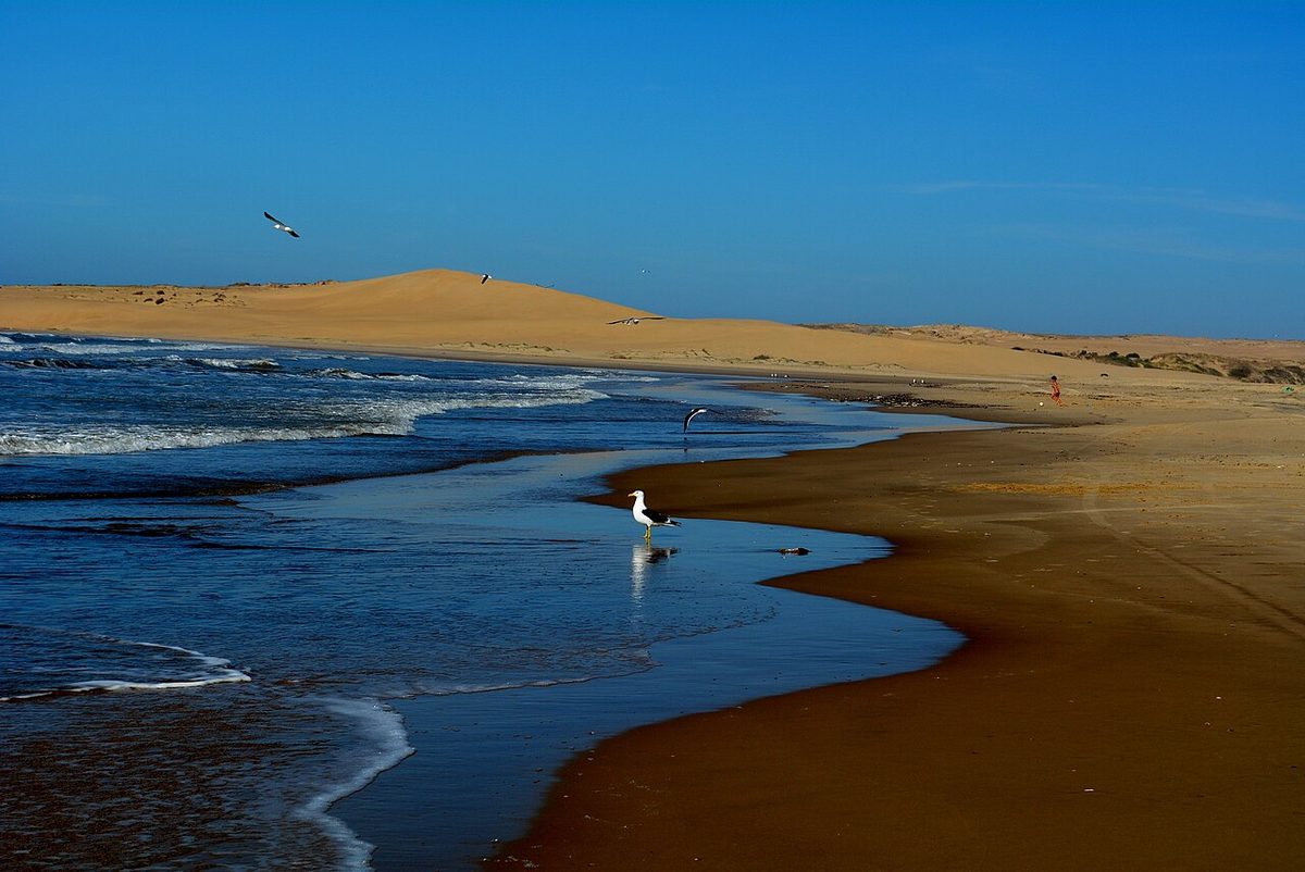
The first time I drove the Rocha coast, I missed a turn somewhere past La Paloma and ended up on a stretch of Ruta 10 where the asphalt simply stopped and the road became hard-packed sand running between low dunes and pine. That stretch is the heart of any Rocha coast itinerary worth driving. No signpost, no warning, just a Uruguayan family in a Gol bumping along ahead of me as if this were the most normal thing in the world. It was. That moment is the whole trip in miniature: the pavement gives out, the crowds thin, and the coast opens up into something wilder than anything you will find back west in Punta del Este.
A rocha coast itinerary is a 5-to-7-day driving trip down Uruguay’s wild eastern seaboard, west to east, from José Ignacio across the Laguna Garzón bridge through La Paloma, La Pedrera, Cabo Polonio, Valizas and Punta del Diablo to Santa Teresa and the Brazilian border at Chuy. You want a car and a loose plan.
What this covers and who it’s for
This is the capstone guide that ties the whole Rocha silo together. I link each stop to its own dedicated guide, so think of this page as the map and the route, and the linked guides as the detail on each town. For the regional overview, start with my guide to the Rocha department; this itinerary is what to actually do with five to seven days once you get there.
Who is this for? Independent travelers who want beaches without the Punta del Este price tag and are comfortable with a few hours of driving a day, some of it on unpaved roads. Couples, surfers, solo backpackers and families all do this route. It is not a luxury circuit and it is not a day trip. If you only have time to compare the two coasts before you commit, read Punta del Este versus Rocha first, then come back.
The Rocha coast itinerary at a glance
Here is the whole route in one table. Distances are approximate and the drive times assume you are not stopping for photos every ten minutes, which you will. Treat them as honest minimums.
| Day | Base for the night | Highlights | Drive that day |
|---|---|---|---|
| Day 1 | La Paloma | José Ignacio, Laguna Garzón circular bridge, arrive La Paloma | ~75 km / 1.5 hrs plus stops |
| Day 2 | La Pedrera | La Paloma beaches and lighthouse, short hop to La Pedrera, sunset at the point | ~10 km / 20 min |
| Day 3 | Cabo Polonio | Drive to the park gate, leave the car, dune truck into Cabo Polonio, lighthouse and sea lions | ~45 km / 50 min plus the truck |
| Day 4 | Punta del Diablo | Cabo Polonio morning, optional Valizas and Aguas Dulces, on to Punta del Diablo | ~70 km / 1.5 hrs |
| Day 5 | Punta del Diablo | Surf, fishing-village mornings, Santa Teresa National Park afternoon | ~25 km / 40 min round trip |
| Day 6-7 | Punta del Diablo or Chuy | Slow days, Laguna Negra, the Chuy border, or simply more beach | Optional ~50 km to Chuy |
Five days is the tight version that still feels complete. Seven days lets you breathe, add Valizas properly, and not drive every single day. Anything less than five and you are skipping a town you will wish you had seen.
The day-by-day Rocha coast itinerary
Day 1: José Ignacio, the Laguna Garzón bridge, and on to La Paloma
Start where the pavement is still smooth and the parking still costs money. José Ignacio sits at the eastern edge of the Punta del Este orbit, a lighthouse and a cluster of expensive restaurants on a low point of land. Have a coffee, walk the beach, then point the car east on Ruta 10. This is where the trip really begins.
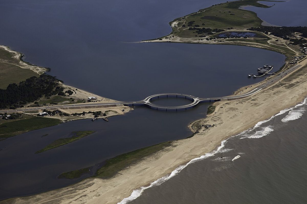
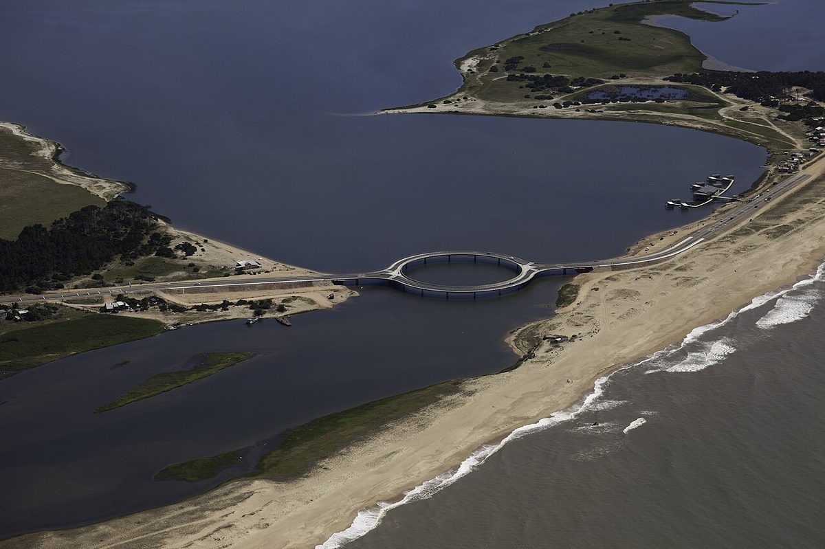
About twenty minutes on you reach the thing everyone photographs: the Laguna Garzón bridge, a circular ring of road over the lagoon mouth that connects Maldonado to Rocha. Cars go around the loop one way, single file, slowing everyone down by design so they actually look at the water and the birds. It is a genuinely lovely piece of engineering and the symbolic gateway into Rocha. I cover the crossing, its history and the toll-free practicalities in my Laguna Garzón bridge guide.
From the bridge it is roughly another hour to La Paloma. The road is paved and easy. You will arrive with the afternoon still ahead of you. One honest note: the few kilometers of Ruta 10 immediately after the bridge can be ripio (loose gravel) depending on the year and recent roadworks, so a little caution and a slower speed pay off. La Paloma is a proper resort town, a balneario in the Uruguayan sense, with a working lighthouse, supermarkets, fuel, and a good range of places to sleep. See my full La Paloma guide for where to eat and which beach is which.
Sleep: La Paloma has the widest accommodation range you will find for a while, from hostels to cabañas (cabins, often self-catering). Book ahead in January; the rest of the season you can usually wing it.
Day 2: La Paloma to La Pedrera
Wake up in La Paloma, swim before the wind picks up, climb the lighthouse if it is open, and stock up on cash and groceries because the towns ahead get smaller fast. Then make the shortest drive of the whole trip, about ten minutes up the coast to La Pedrera.
La Pedrera is La Paloma’s scruffier, artier cousin: a single main street running down to a dramatic point, surf beaches on both sides, and a slower pulse. In January it fills with a young Argentine and Uruguayan crowd and the main street comes alive at night; in shoulder season it is half-asleep and all the better for it. Stand at the point at sunset and you understand why people keep coming back. My La Pedrera guide has the beach breakdown and the timing on the seasonal closures.
Why give a whole night to a town ten minutes away? Because the rhythm of this coast rewards staying put. You could blow through La Paloma and La Pedrera in an afternoon, but you would miss the entire point of Rocha, which is to slow down. If you are tight on time, this is the day to compress: see both, sleep in La Pedrera, push on tomorrow.
Sleep: La Pedrera leans toward cabañas and small posadas. Options are fewer than La Paloma, so in peak season book ahead.
Day 3: Into Cabo Polonio (park the car, take the dune truck)
Today is the strangest and best day of the trip, and the one that breaks the normal rules of a road trip, because you cannot drive to your destination. Cabo Polonio sits inside a national park, about seven kilometers off Ruta 10 across protected dunes, and private cars are not allowed in. You drive to the park gate near kilometer 264, leave the car in the guarded lot, buy a ticket, and ride in aboard a high-clearance 4×4 truck that grinds across the sand for around half an hour.
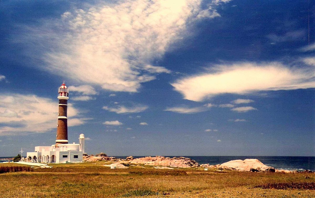
The truck ride alone is worth the detour: open dunes, then the first sight of the village’s lighthouse rising over a headland with sea lions hauled out on the rocks below. Cabo Polonio has no mains electricity and no paved streets. People light their cabins with solar panels, candles and generators. It is rough, beautiful, and unlike anywhere else on the coast. Read my full Cabo Polonio guide before you go, and for the exact mechanics of the truck, ticket prices and timetables, my dedicated how to get to Cabo Polonio guide walks through every option.
One honest drawback: staying overnight in Cabo Polonio means roughing it. Hot water is not guaranteed, ATMs do not exist, the wifi is a rumor, and you carry in what you need. Plenty of travelers visit Cabo Polonio as a half-day trip instead and sleep back in La Pedrera or onward in Punta del Diablo. Both are valid. I think one night off-grid is the highlight of the whole route, but go in with your eyes open and enough cash.
Sleep: rustic cabañas and a couple of hostels inside the village. There is no booking desk on arrival worth relying on in summer, so arrange a bed in advance for January. The rest of the year you have more room to improvise.
Day 4: Cabo Polonio to Punta del Diablo, via Valizas and Aguas Dulces
Catch a morning truck back to your car at the park gate. From here you have a choice. The direct run to Punta del Diablo is short, but the rewarding detour is to swing through Barra de Valizas and Aguas Dulces first.
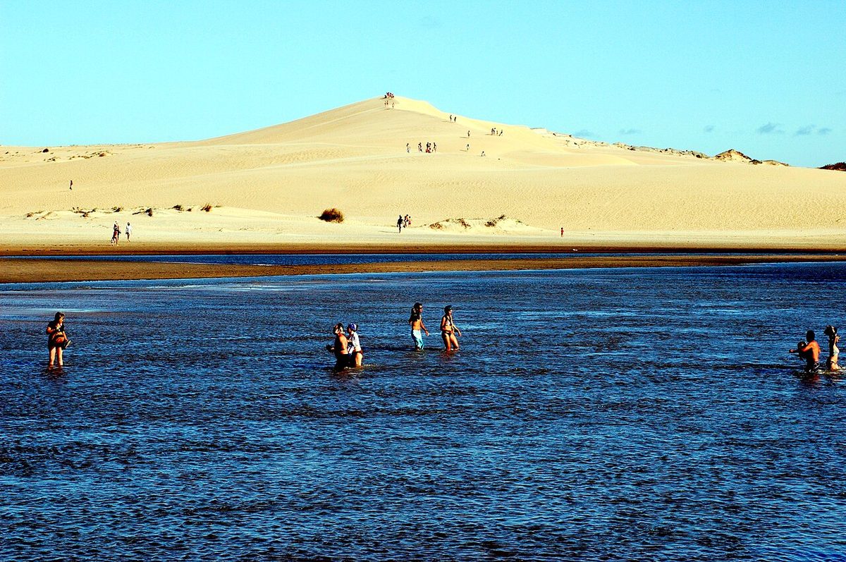
Valizas is a tiny, sandy village beloved by Uruguayan bohemians and backpackers, sitting beside enormous dunes that you can actually walk over to reach Cabo Polonio on foot if you are fit and well-prepared. Aguas Dulces next door is even more low-key. Neither is a polished resort, which is exactly their appeal. My Barra de Valizas guide covers the dune walk and what to expect. Be honest with yourself about the roads here: some access lanes into these villages are ripio and get rutted, and after rain a low-clearance rental will struggle. If conditions look rough, admire from the main road and carry on.
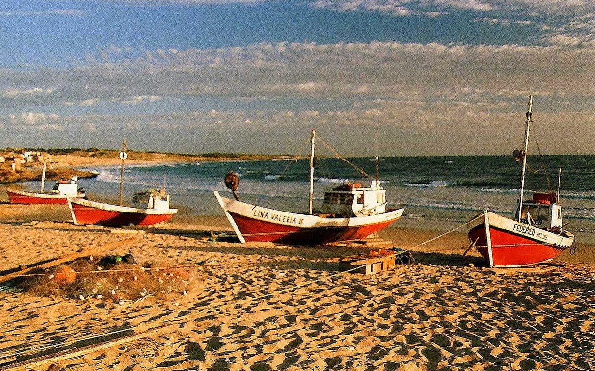
Then it is on to Punta del Diablo, roughly an hour or so up Ruta 10 and Ruta 9 combined. After the silence of Cabo Polonio and Valizas, Punta del Diablo feels almost like a city, and it is still just a fishing village that grew into a beach town. Brightly painted boats sit on the sand, surfers chase the breaks, and in summer the place is packed. This is your base for the rest of the trip. Start with my Punta del Diablo guide.
Sleep: Punta del Diablo has the deepest bed inventory on the wild coast after La Paloma, from big hostels to family cabañas up on the hill. It is the easiest town to find a room in low season and the hardest to find a cheap one in January.
Day 5: Punta del Diablo and Santa Teresa National Park
Give yourself a slow morning in Punta del Diablo: coffee at the fishermen’s cove, a walk along Playa Grande, a surf lesson if the swell cooperates. Then drive about fifteen minutes north to the entrance of Santa Teresa National Park.
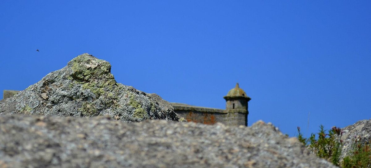
Santa Teresa is a sprawling coastal park of pine forest, long empty beaches and a genuine eighteenth-century hilltop fortress, the Fortaleza de Santa Teresa, built when Spain and Portugal were still fighting over this frontier. You can drive the internal roads, walk to nearly deserted stretches of sand, visit the fort, and see the park’s small plant nursery and bird collection. It is one of the country’s best-loved parks. My Santa Teresa National Park guide covers the fortress, the beaches and the camping, and it sits inside the wider picture I draw in the Uruguay national parks overview.
Sleep: back in Punta del Diablo, or camp inside Santa Teresa itself if you came equipped. The park’s campground is huge and a Uruguayan summer institution.
Days 6-7: Slow down, or push to the Chuy border
Here is where the difference between a five-day and a seven-day trip shows. With two extra days you have options, and none of them involve rushing.
Option one is to do nothing in particular: more beach, more surf, more grilled fish, letting Punta del Diablo do what it does best. Option two is a day trip inland to Laguna Negra, a large freshwater lagoon behind the coast that is excellent for birdwatching. Option three is to drive the last stretch to Chuy on the Brazilian border, a genuinely odd town where the main street is split down the middle, Uruguay on one side and Brazil on the other, with shops trading in both currencies. It is not pretty, but it is a memorable full stop to a coastal trip, and you can stand with one foot in each country.
If you want to fold this Rocha leg into a longer national loop, see how it connects in my broader Uruguay itinerary.
Practical planning: car, season, budget, roads and cash
Car versus bus: get the car
I will be blunt: this route is built for a car. Renting one transforms the trip from a series of logistical puzzles into the easy, stop-where-you-like drive it is meant to be. You can chase a beach you spotted from the road, leave Cabo Polonio whenever you like, and carry a cooler of supplies into towns with one small shop. My guide to renting a car in Uruguay covers the paperwork, insurance and what kind of vehicle to ask for, and the wider Uruguay road trip guide has the national driving picture.
Can you do it by bus? Honestly, yes, and many backpackers do. The company COT and others run frequent services down Ruta 9 connecting Punta del Este, Rocha city, La Paloma, the Cabo Polonio park gate, Punta del Diablo and Chuy. The catch is that buses run along the inland highway and drop you at junctions, not always in the heart of each beach town, so you walk or wait. You lose all spontaneity and the in-between beaches become hard to reach. It is cheaper and perfectly doable for the main towns, just slower and less flexible. If that is your plan, read Uruguay by bus for the honest version. For Cabo Polonio specifically, the bus actually works fine because you have to transfer to the dune truck anyway.
The honest drawback, all in one place: the wild coast is a trade-off. The distances add up, several of the prettiest access roads are ripio that punish a low rental and turn greasy after rain, and you are genuinely far from a hospital or a big supermarket out east. In January the good towns are packed and pricey; in the off-season many cabañas, restaurants and even the dune-truck timetables shrink or shut. There is no perfect window with zero compromise. You really do want a car, you really do want some cash, and you really do need to pick your timing on purpose.
When to go: January crowds versus the quieter shoulder
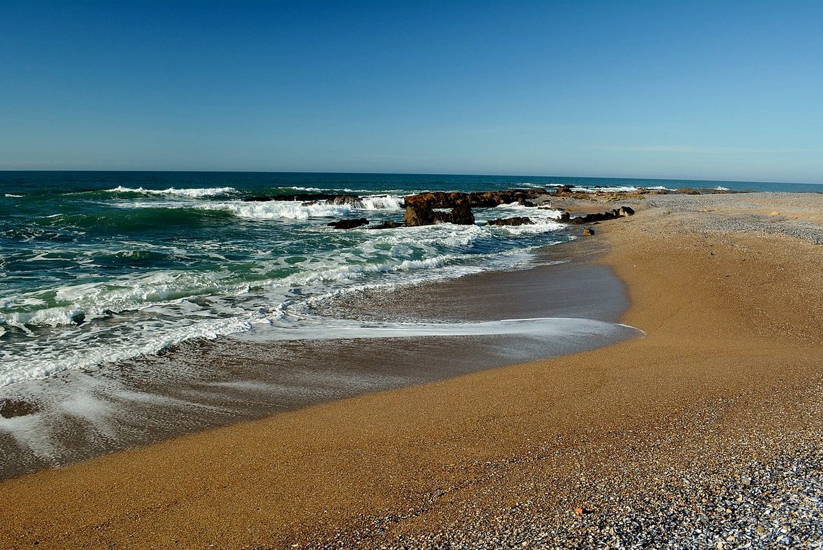
Uruguay’s summer runs December to March, and January is the peak, when Argentines and Uruguayans flood the coast, prices spike, and Punta del Diablo and La Pedrera buzz late into the night. It is fun and it is crowded and you must book ahead. February is a notch calmer with the same warm sea.
The shoulder months, roughly mid-November to mid-December and again in March, are my favorite. The water is still swimmable, the towns are awake but not heaving, and prices ease. Outside the season, say May to September, the coast is beautiful but quiet to the point of closure: many businesses in the smaller villages simply shut, and the dune-truck and bus schedules thin out. For the full breakdown see my best time to visit Uruguay guide. If beaches are your whole reason for coming, cross-check the best beaches in Uruguay roundup too.
A budget sketch (hedged, because it moves)
Prices in Uruguay are not as cheap as the rest of South America, and the exchange rate moves, so treat these as rough orientation rather than gospel. For two people sharing, mid-range and self-catering some meals, you might budget around 80 to 140 US dollars a day all in during shoulder season, climbing sharply in January. Hostels and camping bring that down a lot; cabañas and restaurant meals push it up.
The fixed costs to plan for: car rental (often around 40 to 70 dollars a day depending on season and vehicle, plus fuel), the Cabo Polonio dune-truck round trip (a few hundred Uruguayan pesos per person, so a handful of US dollars), national park entry where charged, and your beds. Fuel is a real line item given the distances. None of this is precise, and January roughly doubles the accommodation math, so build in a buffer.
The roads: paved, ripio, and what to expect
Three road names matter on this trip. Ruta 9 is the fast inland highway, fully paved, the spine that buses use and the quickest way to cover distance. Ruta 10 is the coastal road, paved in long stretches but unpaved (ripio) in others, especially the wilder eastern sections and the access lanes to small villages. Ruta 15 links Rocha city down to La Paloma and is paved. The short connector roads off these into beach towns are the ones most likely to be loose gravel.
Ripio simply means an unpaved gravel or dirt road. It is normal in rural Uruguay and most rentals handle the maintained stretches fine at a sensible speed, but loose corners, washboard surfaces and post-rain mud are real, and you should slow down and not expect to make city-road time. If you are nervous about it, the practical move is to stick to Ruta 9 between towns and only take the coastal ripio when the weather is dry.
Cash, fuel and supplies
Carry cash. The bigger towns (La Paloma, Punta del Diablo) have ATMs and card-friendly businesses, but Cabo Polonio has no ATM at all, Valizas and the smaller spots are unreliable, and the dune truck and many tiny shops want pesos in hand. Draw out money in La Paloma before you head east and keep a reserve. Fill the tank when you see a station rather than when you need one, because they are sparse out east. And bring layers: the Atlantic wind is cool even in summer evenings, and an off-grid night in Cabo Polonio gets genuinely dark and chilly. For the wider question of where to base yourself across the country, my where to stay in Uruguay guide helps.
Rocha coast itinerary: your questions answered
How many days do you need for the Rocha coast?
Five days is the realistic minimum to see La Paloma, La Pedrera, Cabo Polonio, Punta del Diablo and Santa Teresa without feeling rushed. Seven days is the sweet spot, adding Valizas, a slower pace, and a day for the Chuy border or Laguna Negra. Three or four days forces you to skip a town you will regret missing.
Do I need a car for a Rocha road trip?
You do not strictly need one, but you really want one. Buses connect the main towns down Ruta 9, so a car-free trip is possible. A car gives you the in-between beaches, freedom to leave Cabo Polonio on your own schedule, and the ability to carry supplies into villages with one tiny shop. For this coast specifically, a car is worth the cost.
Can you drive into Cabo Polonio?
No. Cabo Polonio sits inside a national park about seven kilometers off Ruta 10 across protected dunes, and private vehicles are banned. You park at the guarded lot by the park gate, buy a ticket, and ride in on a high-clearance 4×4 truck that takes roughly thirty minutes across the sand. It runs on a timetable that thins out off-season.
Is the Rocha coast road paved?
Partly. Ruta 9, the inland highway, is fully paved. Ruta 10, the coastal road, is paved in long stretches but turns to ripio (gravel) in the wilder eastern sections and on the short access lanes into small beach towns. Most rentals handle the maintained gravel fine at a careful speed, though rain makes it greasy.
When is the best time to drive the Rocha coast?
The shoulder months, roughly mid-November to mid-December and March, give you swimmable water, awake-but-uncrowded towns, and easier prices. January is peak: warmest, liveliest, most crowded and most expensive, and you must book ahead. From May to September many small-town businesses and the dune-truck schedule shut down or shrink.
Is the Rocha coast safe for tourists?
Yes, broadly. Rocha is a low-key, family-friendly stretch and violent crime against tourists is rare. The real risks are practical: long sparse roads, ripio surfaces, strong ocean currents at some beaches, and being far from services out east. Drive sensibly, respect the sea, carry cash and fuel, and you will be fine.
Final thoughts
What stays with me about the Rocha coast is not any single beach but the gradient of it: the way the polished resort world of José Ignacio dissolves, town by town, into pine, sand and silence until you are standing in a village lit by candles with sea lions barking below the lighthouse. Drive it slowly, take the ripio when the weather is kind, carry pesos, and give Cabo Polonio its one strange night. Five to seven days is enough to feel the whole arc, and to understand why Uruguayans guard this coast so jealously.
Credits & sources
Sources & further reading
- Route 10 (Uruguay) on Wikipedia for the paved-versus-unpaved breakdown of the coastal road.
- Guru’Guay’s east coast itinerary, a long-running local-expert resource on travel in Uruguay.
- Wikivoyage’s guide to the Uruguayan coast for practical transport notes.
Photo credits
All images via Wikimedia Commons: Rocha Wild Coast Valizas Dunes by Andrés Franchi Ugart… (CC BY-SA 3.0); Laguna Garzon Bridge Uruguay by Jimmy Baikovicius from Montevideo, Uruguay (CC BY-SA 2.0); Cabo Polonio Lighthouse Rocha by rodoluca (CC BY-SA 3.0); Punta Del Diablo Boats Uruguay by rodoluca (CC BY-SA 3.0); Rocha Beach Uruguay Coast by Elvis Boaventura (CC BY 3.0).